


After fishing the South Fork, I hoped that the North Fork would be a little bit better. It certainly had a significant amount of water — a veritable torrent after the dim flow I saw in the South Fork. Unlike the South Fork, the stocked water signs start immediately upstream of the parking lot and continue all the way up to the end of the road.
Getting to the river is as simple as walking 10 yards away from the parking area and beginning to fish. On this morning, there was good flow in the river with the deeper sections being a foot or more deep. Later in that afternoon, I chatted with Gordon English at the Albemarle Angler Fly Shop and he told me that the water volume was low for this time of year. Thankfully, there was still plenty of water to support whatever fish were there on this day .
I began to wade and fish my way upstream; encountering the first significant pool at the bend in the river where Pond Ridge Branch joins the flow. I flipped streamers and even tried a dry fly or two (early-season patterns — BWO and stonefly) with no results. Feeling a little bit frustrated after my lack of success on the South Fork, I continued to fish my way upstream. I was thankful that the rocks here are not as slick as they are over in Maryland although I still felt like I needed a wading staff to keep from killing myself.
As you move upstream, the high bank is to your right (east) and the easier walking is on the gentle slope to your left. There are plenty of sticker bushes – each of which extends long tendrils of thorns that cause plenty of problems and demand caution to keep from poking holes in your waders. You do not need chest waders here; hip waders are more than enough.
After the bend, the river narrows to about 10 feet wide with the typical deeper pools huddled behind boulders where the current breaks down the hill. I fished the more productive looking ones without success. After fishing upstream for a little over half a mile, I decided to call it a day. I climbed out of the river near the upper parking lot (that marks the end of the stocked section) and walked down the road to the truck. There is a tree that has fallen across the road about 100 yards down from the top so you cannot drive all the way up to the parking area.
I knew this water had been stocked about a month earlier, and was hopeful that there still might be a fish or two left. I came to the same conclusion that I did on the South Fork – there’s just not enough water here to allow the fish to hide and live for very long. Those who do not get snaked out by fishermen (perfectly fine – this is put and take) certainly get eaten by predators. Given that, I recommend you only come here within a week or two after stocking. As fate would have it, this river was stocked the day after I fished it — bad timing on my part!

Bottom line: This water is only worth a visit once in each season and then only when it has been stocked. Given the proximity to Charlottesville and the easy access, this water gets plenty of pressure. In fact, there were three or four other trucks in the parking lot the day I was there.
Getting There: From I64, take exit 118B onto Rt 29 north. Get onto Rt 250 west at Ivy Road. Turn right onto Brown’s Gap Turnpike (Rt 680). It merges with Rt 789 and then “T”s into Garth Road at White Hall. Turn left and follow Garth Road until it makes a sharp right bend at a small gas station. Turn left at the bend onto Sugar Hollow Road (the gas station will be on your right as you pass it). Follow Sugar Hollow Road all the way to the parking lot at the north end of the lake.
Google Local Coordinates: 38.138978,-78.748283
Secrets Revealed? No. This is a very public location that is documented in the following places:
Virginia VDGIF
Flyfisher’s Guide to Virginia
Virginia Trout Streams
Date Fished: 03/24/2009
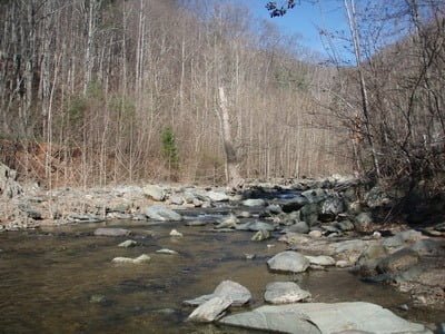
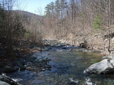
Looking downstream from entry point

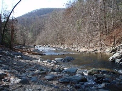
Upstream from entry point
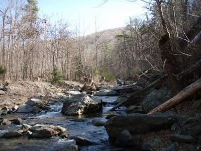
Nice pool midway up
You have to walk around a steep bank on the right
Nice pool at upper area
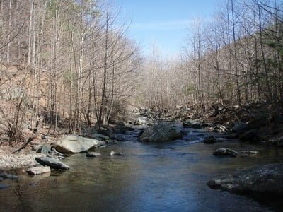
Looking downstream from the end – plenty of water
Unless stated otherwise, this article was authored by Steve Moore