


I woke up to blazing sunshine — a glorious early spring day made even more spectacular because I had the day off from work. When I combined that with the start-of-season urge to see new water, I pointed the truck south and headed towards the South Fork of the Moormans River. I had been cautioned about expecting too much by a reader. He pointed out that neither the South nor the North Fork had returned to their previous peaks of glory after the horrible storm that occurred in 1995. But the South Fork was on the VDGIF stocking plan and had seen a load of fish dumped a few weeks ago. So, what did I have to lose? At worst, it would be looking at pretty water on a glorious day. At best, there may be a stocker or two waiting to fall victim to my presentation.
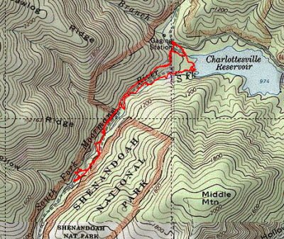
My continuing beef with the VDGIF stocking plan is that it is not specific about how to reach stocked water. The South Fork of the Moormans was no exception. Looking at the Trout Area Map for Area 2, you see the short squiggle at the upper left end of Sugar Hollow Reservoir. With that as the only thing to guide me, I concluded that I had to cross the North Fork, which joined the reservoir at the upper right, and move south around the lake.
I sloshed across the river to a gate secured with a heavy wire rope. Recognizing this as the access route for the stocking truck, I followed the road to the west up a steep hill. After walking on this hill for a quarter-mile, the road moved farther away from the river, leading me to conclude that this could not be right. I walked back down to the lake’s edge and followed a small fisherman’s path around the shore until it joined with the dim volume of water that was the South Fork. “Well, there might be brookies here,” I told myself, and I began to bushwhack upstream.
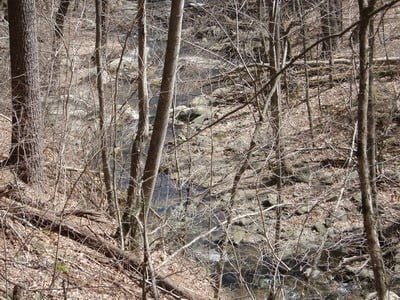
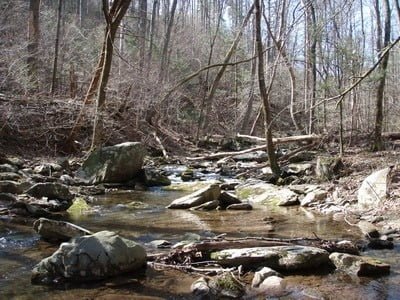
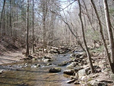
The river appeared to be a typical Shenandoah/Blue Ridge Parkway stream. The first look upstream revealed a gently flowing 10 to 15-foot wide stream that was tragically shallow. In the initial section, the water level would be lucky to get to a foot and was generally only inches deep. The deeper sections clustered around fallen trees and other detritus accumulated in the various storms over the years. There were a few cliff faces that provided good shade and protection over some deeper two-foot pools. While I enjoyed the scenery, it was tough bushwhacking through the dense vegetation that collected on the stream banks. There was the assorted mix of dense saplings interspersed with half-inch wide thorn branches that dragged at my jacket and happily lunged to puncture my hip waders.
About a mile upstream, I realized that this was a losing proposition. I could see a line cut high on the hillside above that I concluded was the road; I wished I had remained on that path. Since the road ran west and seemed to follow the stream, it had to be how the stock truck would get back to do its duty.. Looking for an easy way out, I staggered up the hill and was happy to poke my head over the crest and see the roadbed loom into view. A few hundred yards later, the road and the first of several “stocked trout water” signs appeared. Unfortunately, the character of the water did not seem much better up in this area.
At this point, I realized that while I was normally “Mr. prepared and ready for everything” on this day I was not prepared for anything. Given the small squiggle on the trout area stocking plan, I had assumed I would just take a quick walk in and out and had not brought any water with me. Since I was still inclined to see what we ahead, I decided to press on with a lesson learned for next time. The road paralleled the river on the west bank for the additional half-mile I walked. I continued to see widely spaced “stocked trout water” signs confirming the river to my right was still within the zone. However, the quality of the water never improved. If trout were stocked here, they were unceremoniously dumped into shallow water and probably only lived for a few days before they fell victim to predators. I can’t imagine they found anywhere to hide for very long. Conclusion? This is a fishable river within the first few days after stocking and not worth it after that.
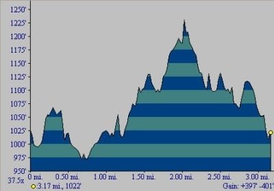
Elevation profile – total gain was 397 feet up the hill
As I walked up the road, I felt like the “Mantracker” character on the TV show. He’s the professional tracker who uses his skills to catch fugitives or, in the case of the TV show, poor souls signed on to be his “prey”. I looked for dim trails leading away from the road under the assumption that they would lead to the “better” spots. While that was true, there were no fish in those locations. So, I chalked this up to a good walk in the woods and headed back to the truck.
Later in the day, I swung by the Albemarle Angler fly shop in Charlottesville to pick up a new stream thermometer. While there, I spoke to Gordon English who confirmed the dismal outlook of the South Fork. In addition confirming my suspicions about the brief life span that any stocked trout would enjoy, he said that it did not support brook trout either as a result of the accumulation of silt and the loss of habitat after the 1995 storm.
Moormans Trout Fishing Bottom line: The first thing is – do not bushwhack! Suck it up, head up the hill and stay on the road until you reach the river. Fish upstream from there for about a half-mile and only bother to come within the first week after stocking.
Getting There: From I64, take exit 118B onto Rt 29 north. Get onto Rt 250 west at Ivy Road. Turn right onto Brown’s Gap Turnpike (Rt 680). It merges with Rt 789 and then “T”s into Garth Road at White Hall. Turn left and follow Garth Road until it makes a sharp right bend at a small gas station. Turn left at the bend onto Sugar Hollow Road (the gas station will be on your right as you pass it). Follow Sugar Hollow Road all the way to the parking lot at the north end of the lake.
Google Local Coordinates: 38.136109,-78.751684
Secrets Revealed? No. This is a very public location that is documented in the following places:
Virginia VDGIF
Flyfisher’s Guide to Virginia
Virginia Trout Streams
Date Fished: 03/24/2009
View from the road looking towards the
lake from GPS 38.13545, 78.75483
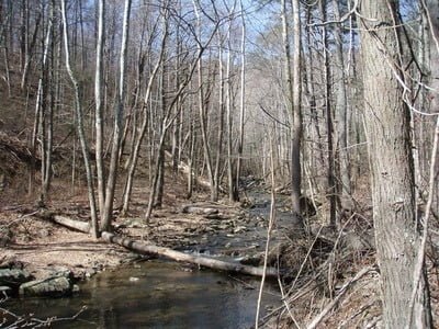
Looking upstream from the lake
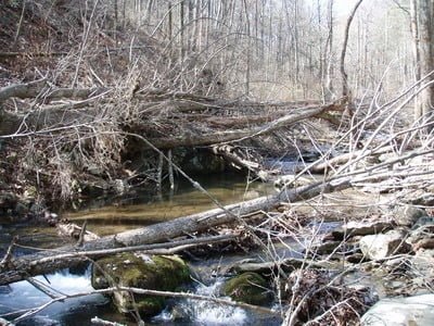
Typical huddled mass protecting deeper water
Shallow and random

Deeper spot near the cliff face
Start of stocked water

This is as good as it got in terms of depth.
Unless stated otherwise, this article was authored by Steve Moore