After a good time fishing Middle Fork, I decided to take a quick run north to check out the stocked section of the Upper Savage River. For those of you who are not aware, Maryland does not stock the special regulation section at all. Any reference to the Savage River in the stocking plan refers to this section.
After a winding drive along the reservoir’s banks, the road began to track next to the river and the stocked water signs became ubiquitous. Sadly, aware that I had to find the places that offered easy access to the truck, I cruised up the road until the signs ran out. Based on that quick recon, I returned to the south and stopped in a few places to get a sense of the environment. The track on the map shows the one place where I walked a little bit because the hole in that location appeared to be a bit deeper than some of the other places. The stocked section spans the entire picture.
The first thing that jumped out was that most of the accessible sections of the river were conveniently located next to small clusters of homes. Undoubtedly, each of those homes contains one or more fishermen who would note the truck’s arrival with glee. In fact, my recon of the river was about two weeks after Maryland loaded this section with 350 fish, and I saw no evidence that any of these remained in the water. The quick lesson is that if you want to fish this water, you must pay close attention to the stocking schedule. After poking around here in a few different places, I concluded that there is nothing remarkable or attractive that would compel fishermen to come back when the alternative is to work the brook trout streams that feed the reservoir or test your skill in the special regulations section a bit farther downstream.
By mid-October, the water levels were still low, which limited the spots where fish could survive. When I stopped in various places, I would first assess the depth of the water and the distance from the road. The good news is that there are enough close spots for the broad fish distribution. But, as I mentioned above, I did not see any life or any movement under the surface as I investigated the area. There was a little bit of a hatch going on – yet I did not see anything rising in response. Since I was here, I have worked with terrestrial, Adams, and streamers with no results.
Quite frankly, I felt a bit uncomfortable fishing this section within view of so many houses. I sensed that I was intruding into public water that was treated as private. Given that, I only spent an hour on this stretch before I moved on. A point of caution is that this posting is only based on a one-hour experience that occurred several weeks after the completion of the minimal fall stocking. It may be worthwhile to revisit this area in the spring when larger volumes of fish are deposited, and the water runs higher – allowing better fish dispersion away from the road. My opinion now is that the Upper Savage is the Maryland version of either Passage or Jennings Creek. The beaten down trail that parallels the stream confirms that people know of this place and are not shy to check it out.

Upper Savage River Trout Fishing Bottom line: If I take the time to come all the way out to the Savage River State Forest area again, the last place I will visit will be this section. I’d rather walk the 2 miles on Middle Fork to get to the good stretch of water that Ann Mcintosh noted in her book. While I have yet to have any success in the special regulation section below the reservoir, it sits out there like a pot of gold at the end of a rainbow — just waiting for my skills to reach the minimum acceptable level which would trigger an enjoyable day in that heavily pressured yet productive stretch.
Getting There: From Luke, MD, head south on MD 135 and continue to follow MD 135 to Bloomington. Turn right on Raley Road and then right again on Savage River Road. You will drive by the special regulation section and the reservoir. Once beyond the reservoir, the stocked section begins on your right as you drive north..
Google Local Coordinates: 39.550251,-79.122849
Secrets Revealed? No. This is a very public location that is documented in the stocking plan available on the Maryland DNR website
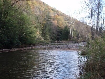
Downstream – note the bare bones sticking up
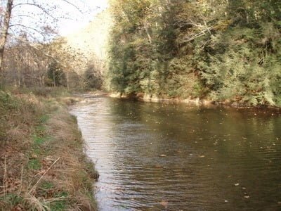
Upstream had some good depth
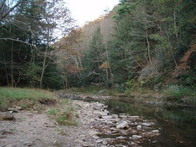
I stopped at another spot just to look around. Pretty deep here as well
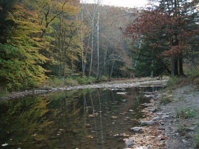
Final stop on the recon. Not bad compared to some of the zero creel limit streams
Unless stated otherwise, this article was authored by Steve Moore
