Approximate Boundary:
Northern Section: 39.675902,-78.042759 to 39.67582,-78.039476 (1,253 ft)
Southern Section: 39.669185,-78.043357 to 39.669376,-78.040364 (997 ft)
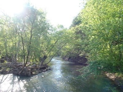
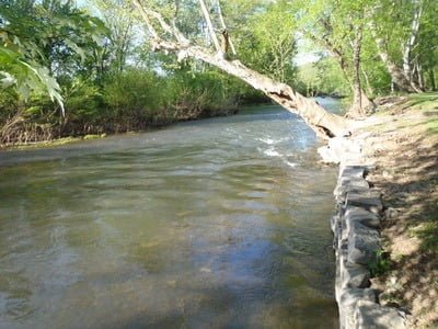
Licking Creek is a broad, fast-running stream that starts at the bridge crossing over Pectonville Road and theoretically continues downstream to the western boundary of Camp Harding Park. I say “theoretically” because there are emerging issues with public access. According to the DNR stocking information published in 2011, access starts at the western edge of Camp Harding Park, extends east, runs around the sharp corner, and returns west to the bridge crossing. Unfortunately, the large middle section may be off-limits to the public, and that is why I have listed the more conservative boundaries above.
In the northern section, there is a small two-car turnout on the south side of the bridge with better parking across the bridge on the small dirt road that extends for most of the “new”, compressed public section. The road is narrow and cannot turn around at the end near the bridge. You should be prepared to back your vehicle out if there are other cars blocking access to the end. The only access to the creek is from the northern bank since the southern shore is a steep cliff face comprised of solid rock. There are two additional turnouts off Pectonville Road before reaching the “posted” sign that marks the end of the public section where the road turns north and moves away from the creek.
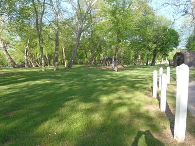
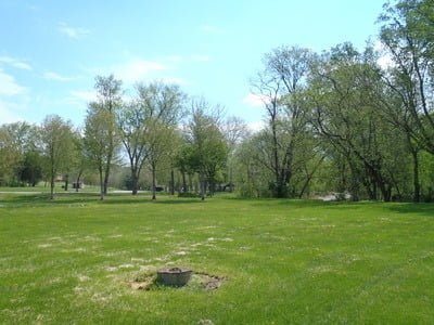
In the southern section, the creek is the southern boundary of Camp Harding Park. The park is open from the first Saturday in May through the last Sunday in October from 9 AM until sunset. Outside of the open season, the County permits walk-in access, but there is limited parking on the side of the road outside of the gate. The park includes pavilions, a playground, restrooms, picnic tables, and everything else one would expect in a well-developed and maintained public park. Fishing can be problematic, given the steep bank. At the western end, it is stark and precipitous, with no opportunity to climb down safely to the water’s edge. Thankfully, the distance between the water and the manicured lawn drops moving east. Once you move away from the western boundary, there is easy access to fish from the manicured lawn, shaded by the tall trees that line the shoreline. At the eastern end, there is a small trail that leads to the end of the public section.
Of historical note is that the Park is named to commemorate the fact that President Warren G. Harding camped here in July 1921 with Thomas Edison, Henry Ford and Harvey Firestone.
Getting There:
East: From I-70, take exit 12 onto MD 56/Big Pool Road heading north. Turn left onto US 40 W. Turn right onto Pectonville Road immediately before US 40 merges into I-70. Follow Pectonville Road north to the Park for access to the southern section. Go through the gate to the parking lots. Continue on Pectonville Road to the bridge crossing to fish the northern section. Go across the bridge and turn right on the small dirt road to park along the creek.
West: From I-70, take exit 9 for US 40 toward Indian Springs (this exit is only available to eastbound traffic). Turn left onto US 40 W. Turn right onto Pectonville Road immediately before US 40 merges into I-70. Follow Pectonville Road north to the Park for access to the southern section. Go through the gate to the parking lots. Continue on Pectonville Road to the bridge crossing to fish the northern section. Go across the bridge and turn right on the small dirt road to park along the creek.
Access Point:
Bridge crossing for the northern section (39.675902,-78.042759)
Camp Harding Park parking lot (39.669185,-78.043357)
Licking Creek Trout Fishing Secrets Revealed? No. This is a very public location that is documented in the Maryland DNR stocking plan.
Tell a friend about this article by clicking on this link

Northern section at high flow

Same section at normal flow

Southern section at east end of the Park – upstream

Park looking downstream

Playground and facilities

Well maintained and manicured lawns
Unless stated otherwise, this article was authored by Steve Moore


