Approximate Boundary: 39.707984,-78.199657 to 39.70592,-78.195602 (1,915 feet)
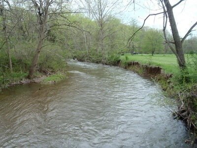
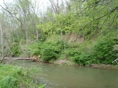
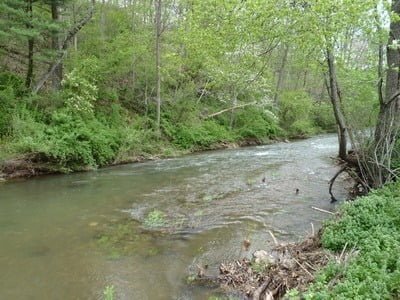
The stocked section starts downstream of the bridge. The best way to attack the water is to drive across the bridge and park near the ball field. Walk around the field to the downstream border of the park and fish upstream. The southern bank, next to the ball field, is accessible, although sharp drops can be seen from the bank to the water level. The northern side backs up on a steep red dirt hill that restricts access until the stream runs through “left field.”. Shortly after the creek takes a sharp turn to the west, it bisects two open fields that offer decent access up to the small footbridge that provides a pedestrian connection. West of the footbridge, fish from the northern bank as a result of the heavy vegetation and rock cliffs in the short section that runs up to the bridge to the south.
The creek is a typical western Maryland freestone stream with a rocky bottom with small, unobtrusive boulders and mixed cobble. Although mostly level, there are a few riffles to provide interest as the stream drops slightly in elevation from west to east. Typically, the bends will hold the deep water and the fish.
Since it will not take long to fish the stream, you may want to build in a visit to the Fort Frederick State Park and its well-known lake called “big pool.” It is a quick 14-mile drive from the creek south to the 585-acre Park. The Park provides a unique venue that permits visitors to gain a perspective on colonial history made even better by taking advantage of the opportunity to chase bass in the lake or in the nearby Potomac River. Beyond fishing, the Park offers plenty of historical programs to include an 18th Century Market Fair in late April, artillery demonstrations as well as other educational, yet interesting, activities.
Getting There:
East: From I-70 westbound out of Hagerstown, take exit 1B onto US 522 S toward Hancock. Turn onto MD 144/Hancock followed by a right toward Limestone Road. At the “T” intersection, turn left on Limestone followed by an immediate right onto Creek Road. Turn left on Kirk Farm Road and drive into the Park.
West: From I-68 eastbound, take exit 77 onto MD 144 E/Western Pike. Turn left onto Sandy Mile Road. Immediately after crossing over I-68, turn right on Creek Road. Turn right on Kirk Farm Road and drive into the Park.
Park at the bridge over the creek or continue across to park next to the baseball field.
Access Point: 39.707868,-78.199764
Little Tonoloway Creek Trout Fishing Secrets Revealed? No. This is a very public location that is documented in the Maryland DNR stocking plan.
Tell a friend about this article by clicking on this link

Downstream from the bridge

From footbridge looking towards field

Steep hill at the turn

Downstream from “center field”
Unless stated otherwise, this article was authored by Steve Moore


