


Approximate Boundary: 39.648668,-78.345873 to 39.708451,-78.330209 (11.22 miles)
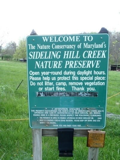
Sideling Hill Creek winds its way through the 3,100 acre Sideling Hill Wildlife Management Area for most of its fishable distance. In the initial northern section, the creek runs adjacent to private property and is actually off limits to fish from the northern bank in the Nature Conservancy. The Nature Conservancy property stretches 1,600 feet downstream from the New Germany Road bridge on the northern bank. The better approach is to go to the defined parking area off McFarland Road and fish upstream or downstream from there to avoid violating the Nature Conservancy restriction. Interestingly enough, the sign posted in the Nature Conservancy parking area indicates that the 400 feet upstream from the bridge has public access for fishing even though the DNR map indicates that the stocked stretch ends downstream of the High Germany Road bridge. Private property borders both sides of the river at the McFarland Road access point and the landowner currently permits access.
The section between the New Germany Road bridge and McFarlane Road features steep banks. Remember, no fishing from the northern bank. At the first McFarlane Road parking lot, there is a faint fisherman’s trail that begins at the lot and moves in both directions on the western bank. Even if you park in the larger lot on the eastern side, the better access is from the west since a steep cliff begins just downstream that will close out progress in that direction.
The next spot downstream is in the Wildlife Management Area at the end of the dirt road that branches to the right off of Whitfield Road. Unless it has been graded and improved, it is a very rough road. Do not be deceived by the fact that it looks gentle as it makes the initial right into the Wildlife Management Area. Conditions quickly change and it becomes deeply rutted (4×4 recommended). At the end of the dirt road, there is a spacious parking lot that will accommodate approximately 10 vehicles. Walk through the yellow gate that restricts vehicular access to the creek and stay to the right along the old road to avoid the “posted” property on the left. The road defines the general boundary between the Wildlife Management Area and private property. The creek is a quarter-mile walk, with a gentle 30 foot vertical drop, away from the parking area. Like upstream, wading access continues to be restricted to the western shore. The steep Sideling Hill ridge rises dramatically on the eastern side.
At Harry Norris Road, access is easier from the turnoffs adjacent to the creek. After turning onto the road, it leads to a hillside overlooking the creek. Do not stop there, instead, drive past an old gate and begin fishing where there are some wooden posts on the left-hand side of the road. Alternatively, continue down to the Nature Conservancy parking lot adjacent to the old Riser Road ford. The banks are steep above and below Harry Norris Road, so be prepared to wade unless you want to fish from the bank next to your vehicle. After disappearing in the immediate area of the road, steep cliffs continue a few hundred yards downstream on the eastern bank and create some dramatic fast water around a rocky bend. After that burst of excitement, the creek levels out, becomes 50 feet wide and runs smoothly into the distance. Rocks predominate as the subsurface structure. Private property borders each side of the road until the creek turns to the east at 39.667297,-78.335248. There is a small game trail on the western bank that leads to a shallow spot where you can wade across. A four-wheel-drive vehicle is not required on this dirt road.
The Cliff Road access point is at the western side of the Green Ridge State Park. There is a small turnout next to an old concrete slab. Here, the general typography reverses itself with steep cliffs being on the west bank heading upstream. Downstream from the concrete pad, Green Ridge Park property continues on the western side with easy access via gentle banks. A word of caution for those who do not have four-wheel-drive. Cliff Road moves up a narrow, slick track next to a steep cliff on the right as you drive farther south that may be tough in a normal vehicle.
The final area to access Sideling Hill Creek is off of Allegheny Line Road on the east bank of the stream inside of the Sideling Hill Wildlife Management Area proper. The road is rough, but negotiable without a four-wheel-drive. After driving along a high ridgeline that makes access to the creek impossible, the road eventually drops back down to parallel the water. There is a 700 foot section that offers turnouts and easy access via a low bank. There are several campsites marked by fire rings as well. Even though the Wildlife Management Area extends in all directions to the east, do not drive any farther since the dirt road does not return to the water.
One final point. Water flow is very low in the summer. This is an “in season” destination.
Secrets Revealed? No. This is a very public location that is documented on the Maryland DNR stocking plan
Getting There:
From I-68, take exit 72.
High Germany Road: At the exit, drive a short distance north on High Germany Road and turn right into the Nature Conservancy parking area on the north side of the bridge.
The following directions assume you are at the intersection of High Germany Road and US 40 on the south side of I-68.
McFarland Road: turn left to drive east on US 40. US 40 becomes McFarland Road. Follow it to the bridge over the creek. There are small parking areas on the right on either side of the bridge.
Whitfield Road NE: Turn left on US 40 followed by an immediate right onto Swain Road. Turn left onto Whitfield Road NE and follow it to a fork in the road. Take the right fork onto the dirt road. You have an opportunity to make a wrong turn to the right when the dirt road forks at 39.68647, -78.32402. Stay to the left, heading east.
Harry Norris Road: Turn left on US 40 followed by an immediate right onto Swain Road. Turn right on Swain Hollow Road NE. Turn right again on Harry North Road. There are several turnoffs as well as a Nature Conservancy parking area at the end of the road.
Cliff Road: Turn left on US 40 followed by an immediate right onto Swain Road. Turn right on Swain Hollow Road NE. At the junction with Harry ignores road, continue to drive straight with the name of the road changing to Stotlemeyer Road. Eventually the road comes to a fork with Hoop Hole Road on the right and Cliff Road on the left. The parking is where Cliff Road rejoins the creek.
Allegany Line Road: turn right on US 40. Eventually changes name to Turkey Farm Road NE. Follow Turkey Farm Road. Turn left on Orleans Road NE. Turn left on High Germany Road SE. turn left on Ziegler Road. After crossing the bridge over the creek, turn left on Allegheny Line Road. There are several turnoffs on the left side of the road after it rejoins the creek.
Access Point:
· High Germany Road Bridge (39.708694,-78.331107)
· McFarland Road Bridge (39.700275,-78.317076)
· WMA off of Whitfield Road NE (39.685362,-78.31793)
· Harry Norris Road (39.67416,-78.34252)
· Cliff Road at creek (39.66111,-78.36264)
· Allegany Line Road turnouts (39.65338,-78.34123 to 39.653526,-78.342778)
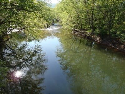
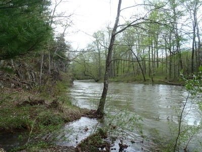
Downstream from New Germany Bridge
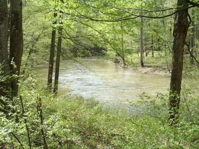
Upstream from McFarland
Downstream from McFarland
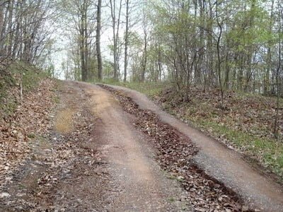
Rutted road into WMA at Whitfield
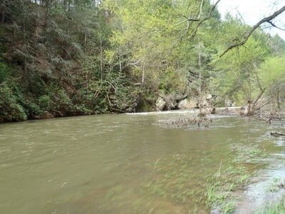
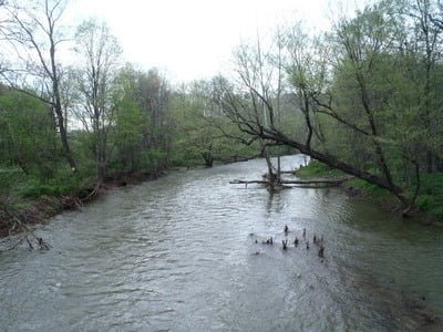
Downstream at Whitfield at high flow
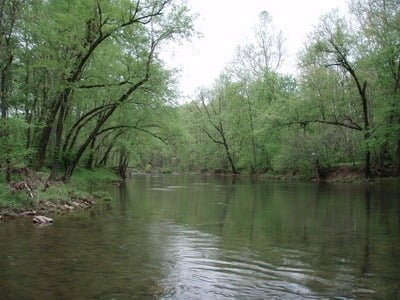
Norris Road upstream from Riser Road
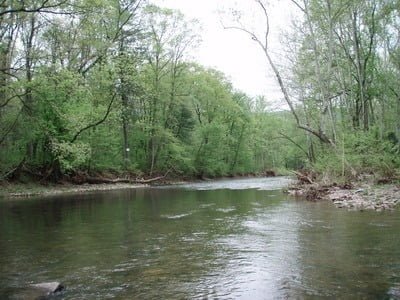
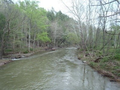
Downstream from Riser Road
Cliff Road upstream
Allegany Line Road at high flow
Unless stated otherwise, this article was authored by Steve Moore