St. Mary’s river is a surprisingly strong push of water that runs out of the St. Mary’s Wilderness on the west side of the Blue Ridge. The other side of the ridge has good wild trout water that I will discuss in a future posting on Mills Creek. I didn’t really know what to expect when I finally found my way into the parking lot at the trailhead (pay attention to the tricky turn I discuss in the directions). In his book, Fly Fishing Virginia, Beau Beasley provides an excellent discussion of the St. Marys. Other than being a little bit confused on how to find the parking area, it’s an easy drive over from I-81.
Once you roll into the parking lot, you’ll be pleased to discover that the river is directly adjacent to lot and the well marked trail moves directly west past the kiosk that has the normal warnings you should pay careful attention to as you enter a wilderness area. The trail is small, narrow and rocky and you need to watch your step as you walk because you’ll be distracted by the great-looking water immediately to your right.
While I expected a small Shenandoah stream, St. Marys River is actually what could classified as a “river” in Virginia on this early April day. It was 30 feet wide in places with a good depth of flow after the spring rains. Each bend typically has a deep pool where the rush of water carves a channel in the riverbed as it boils down the gentle gradient into the Shenandoah valley. There is no sand in this river at all. It’s uniformly cobble with boulders providing interesting targets throughout its course.
Speaking of its “course”, this is a river that cannot make up its mind on which way to flow. At the water level I encountered, I did not have any problem determining the main channel of the river. But a quick look at the numerous side channels cut when the water was running full indicate that the river does not feel constrained to any rigid boundary — it moves everywhere along its journey downstream. This is surprising given the narrowness of the valley. The hills push in close on each side to restrict flexibility, but the river makes the best use of that limited freedom of movement.
The trail follows the river all the way up. I only walked in 1.6 miles and did not go all the way to the falls since I had to get back early. I’m told fishing is good in the vicinity the falls as well as above it. That said, there’s plenty to enjoy in the first 1.6 miles. I decided to put some distance between myself and the parking lot and did not start to fish until I was a half mile in. At that point, there are a series of what I initially thought were pools. Some are and some are not. The light plays tricks that capitalize on the crystal clear, flat nature of the river in the few places it drifts across a level section. With many pools, once you approach cautiously by balancing precariously across the boulder strewn stream bed, you discover that it is a shallow run. However, they are worth fishing as well. Even the shallow runs have a deeper course at some point where small brook trout will hold; look for the slightly darker shade of water that indicates greater depth.
I started out the day using dry flies (Adams, March Brown) but they did not generate much interest, the only “hatch” in progress with the mosquito hatch. I even tried one of those patterns without success. I switched to nymphs. Once I tied on a small Copper John I began to pick up small trout ranging in size from 3 inches to the beauty I show in the picture below. I did have some takes on my indicator that drove me absolutely nuts because I just switched from dry flies. Some fly tyer someplace will figure out how to attach a hook to a small indicator and make a fortune either as a joke or as a serious pattern.


Probably the best way to fish this river is to backpack in and spend the night. If you do that, pay attention to the Forest Service guidance that requires you establish your campsite 150 feet away from the trail. As you walk up the narrow valley, you’ll appreciate what a challenge that could be since the sides of the steep hills form a sharp “V” with the river at the bottom. I suppose there must be some places where you can pitch a tent that would not be on a boulder field or they would not permit camping at all. Of course, the pessimists would argue that the regulation requiring the distance from the trail is only intended to hide the bodies of campers who have been eaten by the bears that are prolific in this area. That way, day fisherman and hikers will not have their day disrupted with a gruesome find.
St Marys River Trout Fishing Bottom line: I love this river. I will come back here again when I have more time to spend and penetrate all the way to the headwaters above the falls.
Tell a friend about this article by clicking on this link
Getting There: From I-64/81, take exit 205 for Raphine, VA-606. Head east on VA-606. Turn left on US-11 in Steeles Tavern followed by a right onto VA-56. Follow VA-56 to the junction of Rt 608 (S. Bottom Road). Turn left onto Rt 608 and be alert. After 2+ miles, you will cross over St Marys River – there will be a bridge on your right. Turn right immediately after the bridge to stay on Rt 608. Follow it for a mile and a half to turn left onto St. Mary’s Road. Follow this road all the way to the end. Do NOT turn left on FR 42 at the fork.
Google Local Coordinates: 37.925107,-79.13766
Secrets Revealed? No. This is a very public location that is documented in all of these places:
Virginia VDGIF
Flyfisher’s Guide to Virginia
Virginia Trout Streams
Virginia Blue-Ribbon Streams
Fly Fishing Virginia
Date Fished: 4/7/2010
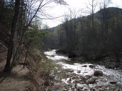
Gentle section… note narrow trail
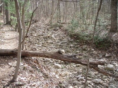
Dry streambed … one of many for when the river runs wild
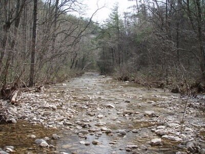
Even spots like this have holes to target
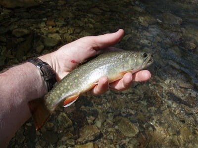
Jackpot on a Copper John!
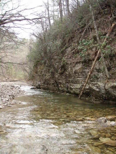
Hit the head and tail of places like this
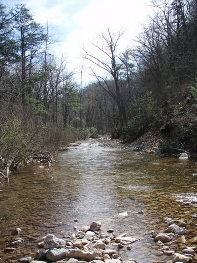
This was the most productive stretch I found… ending at the pool at the top of the picture
Unless stated otherwise, this article was authored by Steve Moore

