Whitetop was totally blown out the day I visited it in early March. I had taken a few days to check out various streams down in the southwest corner of Virginia. I had had a great day on Big Tumbling Creek and Big Wilson with two spectacular late winter days. Sadly, that luck ran out. The day before going to Whitetop, Abingdon got almost an inch of rain. When I checked in at the Virginia Creeper Fly Shop to pick up some flies and advice, all they could do was give me a sympathetic nod, comment that the fishing would be lousy and recommend that I just head down to the Holston in TN where the dam would hold back some of the sludge.
I looked out their window and observed the torrent of rain and the thick, muddy water crashing over the top of the drainage ditch in front of the store, and I knew they were correct.
But, what the heck? I was here. I needed to see the lay of the land to plan future trips, so early the next morning I packed up and drove over to Taylor’s Valley. At Taylor’s, you have two choices. You can park right over the bridge and follow the Virginia Creeper trail downstream or drive a bit farther and follow the same trail upstream. For no particular reason, I headed upstream and followed the road until it dead-ended.
The water was nasty, nasty brown. The volume was intense; the levels were exceptionally high. I knew that even throwing the last, desperate technique of a dark-colored bugger was not going to provide any luck, but I geared up and walked north.
The Virginia Creeper trail runs next to Whitetop for many miles. It is a highly improved, wide, and level trail that makes for easy, high-speed walking. I fell in with a hiker who had enjoyed a soaking night, and we chatted as we walked together. The key news from civilization he wanted to hear was the weather report for the next day. I told him that he was in luck. It would be bright, sunny, and reasonably warm, poking into the high 50s. Thankful for that positive news, we parted ways when I just could not resist throwing something at this water.
I slid down the steep bank to perch on a small rock overhanging the raging torrent. My strategy was simple. The stream took a bend just downstream, and my hope was that I could float some nymphs down the seam between the high volume and calmer water. I hoped that the trout would hang out there, out of the dense push of staggering amounts of runoff, to save energy and take a random bit of chow. I worked the shelf for about 30 minutes. No luck. None really expected.
I looked around to assess the situation. Clearly, it was not going to improve. But I could review the general terrain and get a good feel for this location. The river is about 30 feet wide, with plenty of rocky structures poking up above the high water. This is plenty of room to provide space for error and room to make mistakes for those of us who remain at the stage of “new fly guy”. I could tell that this would be a fantastic section of water to work up.

The trail follows the stream for miles. That undoubtedly means that the middle section that is the farthest removed would be the least pressured. I’m hopeful that the broad and stable nature of the Creeper trail means that some type of stocking can occur in the middle as well as the easy fringes where a large truck could just dump those bad boys in the stream and then run.
This would be a perfect place to bring a bike. You could use it to move quickly up or downstream without having to waste the time hiking in. However, the hike is pretty and would allow you to calm down and get ready to think like a fish.
Whitetop-Laurel Trout Fishing Bottom Line: I would come back here. I’m sure this sees its share of pressure as it is rated as one of the top trout destinations in the state. But the sheer length of the stream has to distribute any pressure. I’m sure if you walk a half mile, you will be alone except for the periodic hiker or biker moving through.
Getting There: Mapquest yourself to Damascus, VA. Head south on 58 and stay to the right onto 91. Go a few more miles. You will cross into TN. Be alert for Dollarsville Road on your left. Take it and follow it to Taylor’s Valley. The name of the road will change to Taylor’s Valley Road when you get back to VA. Follow it through the town and cross the bridge. Turn right (staying on the road) and follow the stream up to the trailhead.
Secrets Revealed? No. This is a very public location that is documented in the following places:
Virginia VDGIF
Flyfisher’s Guide to Virginia
Virginia Trout Streams
Virginia Blue-Ribbon Streams
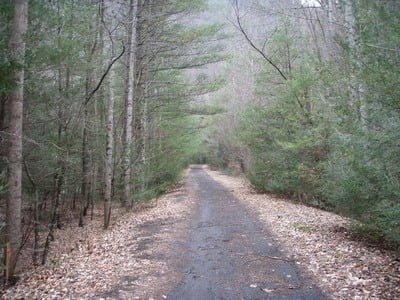
Virginia Creeper Trail
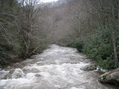
Blown out!
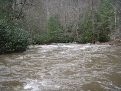
I tried working the nymphs here on the right.
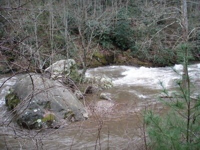
The river divides in spots, looks like plenty of pool locations around the major rock structure
Unless stated otherwise, this article was authored by Steve Moore


