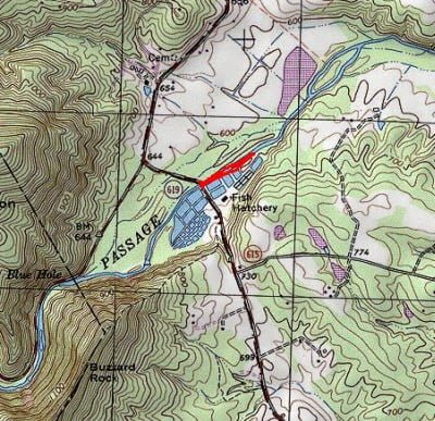
On my way back from fishing Paddy Run, I had an hour before I had to be home, so I pulled off to fish the delayed harvest section of Passage Creek. After gearing up, I began to walk along the stream between the water and the hatchery and was surprised to see that the water was still low after all the rain we had. In fact, I had never been here with the water levels this low and threw an anxious and inquiring eyeball on the streambed to uncover the likely holding positions for trout.
The first thing I noticed was that most of the stream bottom is sheet rock. When the water runs a foot or two higher, it all looks good. But the bare-bones bottom line is that there are few holding positions for trout between the bridge and the edge of the hatchery. Trout would not be interested in hanging over the featureless bottom.
I kept track of this as I walked downstream and turned around at the end of the hatchery to fish my way back up. I targeted the small number of runs where boulders broke up the sheet rock. I had a jolt of adrenaline as a nice trout came up and banged into my orange indicator. This is not fair for December fishing. The fish are lethargic, and to realize one had the energy to come up and slam an indicator was mentally punishing. I dutifully tied on an indicator pattern of approximately the same size and color and flipped it anxiously upstream to the same spot. 10 casts later, I concluded that I had either spooked the fish or it was sulking on the bottom, mad that it spent energy to grab a piece of plastic instead of a fat fly.
Moving upstream, I skipped over the flat rock bottom to the deeper run next to the eastern bank, approximately 25 yards below the bridge. This is clearly the best holding position in the delayed harvest lower area. I fished it for about 15 minutes, moving my nymph deeper and deeper and adding split shot to push it to the bottom.
Nothing. Oh well, the fish could not take away the fact that it was a nice 60° day in late December, I was outside and full of fresh air. As I packed up my gear, I encountered another angler who had had better luck than I in the upstream section. I forgot to ask him what he was using, so I don’t have that small bit of intelligence to offer to you.
Getting There: From Front Royal, go west on Rt 55. Turn left onto Fort Valley Road (Rt 678). Follow it for a bit and turn left on Rt 619. There is a sign at the intersection of 678 and 619 that directs you to the hatchery. Follow 619 until you cross Passage Creek. Pull off on the hatchery side of the bridge. There is parking on the side of the road on both sides.
Google Local Coordinates: 38.948903,-78.296428
Secrets Revealed? No. This is a very public location that is documented in the Virginia VDGIF stocking plan and in the Flyfisher’s Guide to Virginia.
Tell a friend about this article by clicking on this link
Date Fished: 12/23/2011
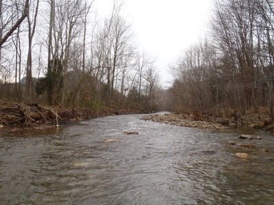
Downstream from the end of the hatchery.
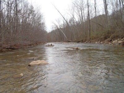
Upstream from the end… good place that does not have slick rocks
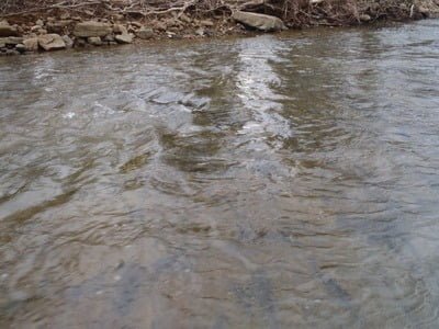
Slick rock bottom without fish holding structure
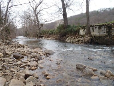
The deep hole near the bridge
Unless stated otherwise, this article was authored by Steve Moore

