It was my desperate search for water that was not blown out by the intense rain we had in early May that led me back to the Dry River area. It was the weekend of the ninth of May, and I had a good deal going. The basswife was visiting her sister, so I had the weekend to myself. All week leading up to Friday, I watched the weather anxiously as described in the post regarding Sideling Hill Creek in Maryland. Ever the optimist, I blew off the dire predictions and headed to Western Maryland. Sadly, it was not long after I arrived at the motel that the rain began to pound down with increasing intensity, almost guaranteeing the prospect of blowing out all the water I intended to fish.
A quick drive up to Bear Creek, followed by a look at the Youghiogheny in Friendsville and the North Branch in Kitzmiller, confirmed my fate. This was a fishing weekend that was not meant to be. “But” I thought, “perhaps a Dam would protect the downstream flow and moderate it to a fishable level.” With that in mind, I drove to Barnum, hoping the Williams Jennings Dam would control the flow and allow me to salvage the weekend. As I pulled up to the top of the put-and-take area, I was instantly appalled at the dark brown chocolate that streamed in front of me. This was a loser as well. Did I have any other options? Desperately searching for additional options, I remembered that the Skidmore Fork of the Dry flowed out of the base of the Skidmore Dam. Since it was almost on the way home, that would be my solution: my last shot at a fish this weekend. I pointed the truck south into the light rain still falling to head through West Virginia. I would hit Route 33 on the other side of Franklin and follow it over to the Dry.
Two hours later, I crested the hill from West Virginia, anxiously peeking over the side of the mountain to get a glimpse of the Skidmore reservoir and looking for the turn-off. I had been here once before, in January of 2006, on an uncharacteristically warm winter day to do a recon. At the base of the hill, I found the turn and drove up to the trailhead, where I encountered a group of college kids who had picked the wrong weekend to go camping. I’m not sure who looked more like a wet dog – was it the kids or the wet dogs they had with them? But the Skidmore Fork running next to the campsite was clear and free of the silt and mud. It looked a little high, but I figured it might dissipate higher up. After all, I had not been beyond the campsite on my earlier trip and did not know what to expect in terms of either gradient or pools.
With that, I geared up, pulled on my waders, and headed north on the trail. The trail is a wide-access road that runs almost all the way up to the Dam. This made for easy walking until I hit a cluster of fallen trees three-quarters of the way up, which marked the end of any potential mechanized access. Since I was on foot, it was easy to dodge around them and continue.
I checked the stream in various places and was disappointed that it was running high to the point of being unfishable. Although the water was clear, it was far too swift for me to fish. The stream is narrow and tight in the stretch between the Dam and the campsite. This means that on a good day, you don’t get much runway to float a fly or drag a nymph. With an exceptionally swift current, you have no runway at all. All the pools, if there are any, were blown out by the charging water. I was here, so I continued upstream.
My trek was rewarded as I broke out of the forest and stared into a broad clearing that formed the base of the Dam. Looking around, I felt like I was out west. The river in this section was broad and gentle as it had not yet picked up any velocity running on the flat stretch. This is what I was looking for on this miserable weekend. I had already rigged up my fly rod with a pair of nymphs, so I began to fish with them. On the third cast, I was rewarded with my first hit. I set the hook like a pro and brought a nice brookie to hand. As I worked up the stream, I continued to get hits, but did not actually succeed in hooking any additional fish. When one of the brookies hit my indicator, I switched to a dry fly. The Adams I tied on instantly attracted attention from the fishy population. I picked up two additional brookies using this, and then things quieted down. Figuring this was my opportunity to do a triple play, I tied on a Patuxent Special and took a shot at seeing if anyone was interested in a streamer. Surprisingly, I was rewarded and brought an additional brookie to hand.

Recognizing that I had leveraged this short 30-yard section of stream for all it was worth, I turned and headed to the truck. On the way back, I tried to fish in a few other places.
In general, I was impressed with the beauty of the upper section of the Fork. As I moved downstream, I could see a large waterfall spilling over cliffs to my right. Where the flow joined the stream, I gave it a shot but did not have any success. Probably those waterfalls were the intermittent result of the deluge of rain we had had in the previous 24 hours.
The River has a rocky bottom with tight vegetation on the sides and is reasonably shaded from the summer sun by a solid tree canopy. I can see where all of this would facilitate trout survival in the summer months. I’m not sure the Dry River gets much benefit of being a tailwater of Skidmore Dam, given that the Dam does not appear to be that deep. However, I do recall that last summer, at the height of the drought, on my way back from West Virginia in September, I was successful in catching brookies in the middle section of the Dry. Thinking back even farther, I remember fishing right off the road in 2006 on a 4×4 expedition and being successful in picking up some trout.
Skidmore Fork of the Dry River Trout Fishing Bottom Line: This is a nice section of the river. Given the narrow run of the river when it hits the forest, it was a technical challenge for me as a new fly guy. Although I did not get much of a chance to cast given the fast water, it was clear that you needed some skill to work this water. The short section at the top of the trail is nice but is not worth a special trip just to fish 30 yards of water.
Getting There: From Harrisonburg, take Rt 33 west. After you pass the town of Rawley Springs, you are within a few miles of the turnoff and need to stay alert. The turn is an unmarked dirt road at the base of the mountain that marks the border between Virginia and West Virginia. You will probably miss it on your first pass. Once you recognize you are climbing the mountain, turn around and go back. The first dirt road to the west (right) that angles sharply back towards the mountain is the one you want. Follow it to the end and park in the wide parking area. The river is right in front of you.
Secrets Revealed? No. This is a very public location that is documented in the following places:
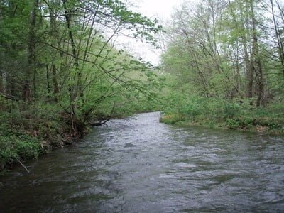
High running, but clear
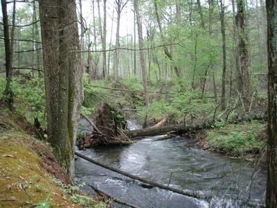
Notice how tight this is!
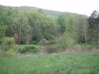
The field at the top
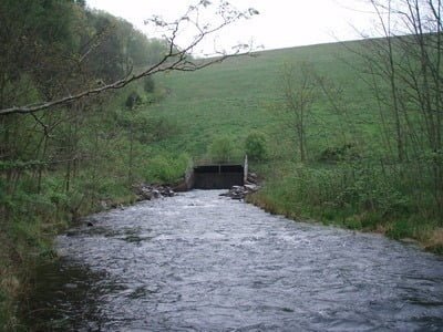
The tailwater from the Dam
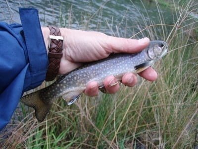
Top end brookie
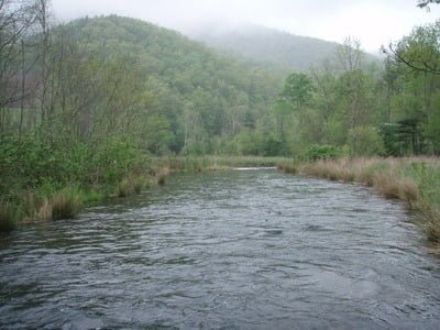
The 30 yard stretch
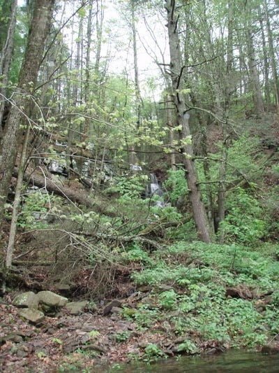
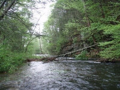
The high rains produced the waterfalls to the left.
Unless stated otherwise, this article was authored by Steve Moore


