After checking out the kids fishing area, I wandered downstream into the general-purpose section that is open to all. I had been told it was heavily stocked for a wounded warrior event the previous month. I was hopeful that some of those fish would still be sculling in the languidly flowing water.
The first thing I look at when checking out a newly stocked section is whether the stocking truck can access the stream. Frankly, the poor stocking people will not haul a couple of fish more than a few yards to populate the stream – it’s just too hard. Starting from the west, there was reasonable access for the first 25 yards of the stream, but then a ravine cuts off further easy progress. I continued east and saw a faint road that generally parallels the stream. I assumed that the stocking vehicle could get access via one of the closed gates I had seen on the way in. However, this entire section is suspect because if that is not true, it will not be heavily stocked beyond easy-to-walk two areas near the kid’s fishing area. The fact that there were plenty of “stocked water” signs posted to the trees was encouraging – there are fish dumped into the stream.
Immediately downstream of the pool, the stream looks reasonably trout friendly. Although it runs over a sand bottom, there is enough fallen vegetation and a few deep holes to provide holding locations. The farther east you walk, the worse the stream becomes. The banks are precipitous and high, looming 10 to 15 feet above the water. The only way to fish is to wade in the stream, and it may be a while before you find a place to exit.
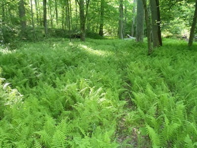
Getting to the edge of the water is very easy. The stream wanderers left and right to a small valley that is carpeted with ferns. These make for easy walking, but you need to be alert for hidden holes that you will not be will to see under the leafy vegetation.
Bottom Line: Hit this the week after it is stocked and don’t bother to go back.
Getting There: Take the exit 148 off I95, go right. A few miles after the Marine checkpoint, turn right following the signs to Camp Upshur. Go past the turn for Breckinridge Lake and continue to the next intersection (Blackrock Road). It’s dirt. Turn left onto Blackrock and follow it around to the pool. The last 25 yards into the pool is steep and rutted. If you have a flatland car, park at the top of the hill and walk.
Google Local Coordinates: 38.55392,-77.43223
Secrets Revealed? No. This is a very public location that is documented in the Quantico fishing regulations.
Tell a friend about this article by clicking on this link
Date Visited: 5/12/2012


Upper nice section near Secon Pool

Upper nice section near Secon Pool

Faint road – hopefully the stocking truck can use it

Thenbanks are unobstructed and easy to reach, but you can see how high they are in this picture and the next

Very high banks

Themare a few sections with rocks in addition to the sand
Unless stated otherwise, this article was authored by Steve Moore


