The Bullpasture River has a good stretch of fishable water starting in the town of Williams and running up through public land for a few miles. However, there are sections in the middle that are posted on the west side. To fish the entire stretch, you would have to figure out a way to stay on the east bank.
I checked out the upper portion, driving in from the North. The public water starts above where I got out to fish as indicated on the map. Above this spot, it is classic road fishing with a goodly number of turnouts next to the road. The river hugs the road and has some very pretty spots that cry out for a throw or two. There are no houses in that section of road as the river and road run against a steep embankment on the western side making this a much better road fishing experience than Irish Creek. I passed up the turnouts in search of a portion of the river where I could walk away from the road and get a little bit away from the beaten path.
I parked at the designated parking area and walked across the swinging bridge to head downstream. I walked as far as I could, but it was not far enough. The bank on the east side closes out with some cliffs that I did not want to climb around that sit across from a section of private property. In fact, you can see all the houses marked on the map. There is a defined trail on the east bank that extends down to the area across from the private property, so you can move in quickly and move out just as fast; easy walking.
The river is broad, wide and pretty deep. I caught a few chubbs, no trout. Once you get beyond the bridge area, there is no real structure to speak of. There are a few sections where the water breaks over rocks, but beyond that, it’s just a wide flat section of water. Not much scenery.
The Bullpasture is stocked and I did catch some nice sized trout farther downstream in the southern section (I’ll post that report later), but I was basically skunked here. I saw a few other guys cleaning some nice sized fish next to the bridge, so trout do exist.
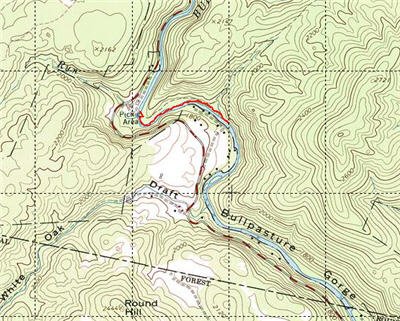
I tried out the hybrid rod in this section and worked it pretty hard with spinners and rapalla minnows. I only fished this section for about 2 hours and then decided to move on. That should be my last shot at using spinners for awhile. I do not want to touch a panther-martin again until I have mastered fly fishing… could be a long, long time….
It looks like there is substantial pressure here. First, the huge parking lot at the top near the swinging bridge is an indicator of popularity. Second, the beaten trail speaks of high traffic. Finally, every muddy area had numerous boot impressions – the closing argument that this is popular.
I was actually very surprised that this was a beaten zone since it is such a long drive to get there. It was about another hour past Ramsey’s Draft given the small roads and low speed limits. My conclusion is that the local crowd hits this pretty hard following stockings.
I also wonder if this river warms up in the summer. The water was a nice 51 degrees when I was here in late April, but the river is wide enough to prevent the bordering trees from offering much shade.
Bottom line: I’ll skip this section in the future. If you come all the way out here, you may as well spend the time to go to the Jackson.
Getting There: Mapquest yourself to Williams, VA and keep driving north. You will see the parking area on your right about 2 miles outside of Williams.
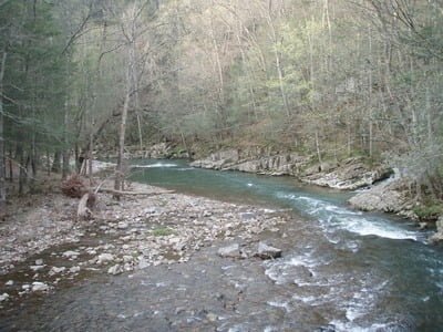
When you walk across the bridge from the parking lot, you get excited when you look downstream and see water like this. Sadly, it is the only good stuff you will see on this section (although there are some pretty spots off the road farther north than where I fished).
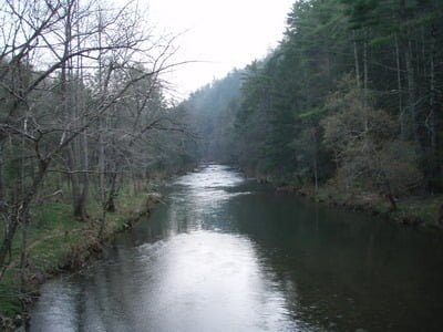
Looking upsteam from the top of the bridge
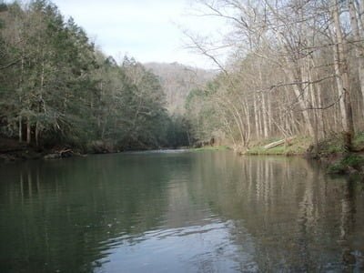
Once you round the corner, the water runs wide and flat
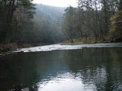
Just a few riffles in two spots to break the run
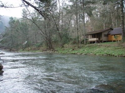
At the southern end of the track, you get closed out by private property
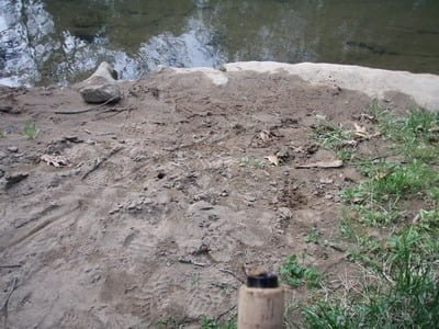
Look at all these footprints. This place sees a lot of use.
Unless stated otherwise, this article was authored by Steve Moore


