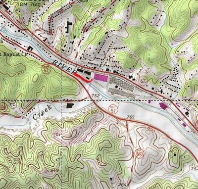
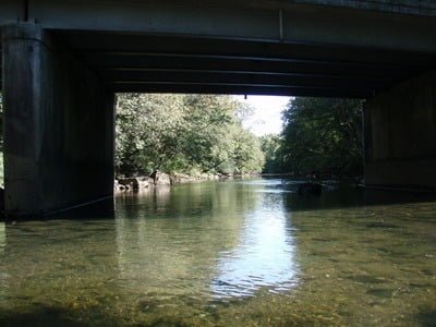
My next bridge down on the Smith was a quick turn from Rt 57 to approach the river from the East. The bridge was blocked by two large concrete “jersey barriers” as it is under repair. In addition, deciding where to park required some thought. On the right, there was an active factory, and it looked like the parking area on the right side of the barriers was on their property. I did not want to go on the other side of the barriers (although there was plenty of room to pull around then) as I assumed that would make me eligible for a ticket. Looking to the left, I decided that the space next to the fence was OK. No posted signs and no “no parking” signs. If you fish this stretch, I recommend you approach from the west as it looks like that side of the bridge had more “standard’ road parking – and there is no factory on that side.
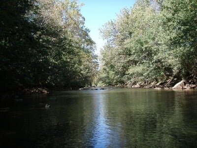
Access to the river is easy. There is a well-worn path on the right side of the bridge. A few hops on some rocks and concrete blocks, and you find yourself in the river looking upstream at some nice water. Like the Trenthill bridge, the river is reasonably wide here – maybe 30 feet. The bottom is a mix of sand and rocks. I discovered as I moved downstream that the character of the bottom slowly changes from rock to stand. This spot was a transition area and the downstream stretch looked like it was even more sandy in comparison.
The river sported the typical rocks poking out of the mainstream of the current. They were small, nothing big, and did little to separate the current and create deep cuts or seams that would be the natural spots to hold trout. Given this, I targeted the calm areas I could see and was instantly rewarded with some strikes on the Adams pattern I was using. I picked up some small trout and slowly worked my way upstream.
The noise of the factory on the right provided the musical backdrop to my fishing. Thankfully, it was not loud or persistent enough to be obnoxious. I spent enough time on this section to decide that it merited more time, but I had to move on as I executed my bridge strategy.
On the way back out, an older guy (got to be careful who I call old these days as I turn 57 this year) wandered onto the bridge and started looking around, gazing both up and downstream. I walked over and asked him if he had any advice on fishing. He said that he was looking to see if the stock truck had arrived yet. Apparently, the first week in October is the “regular” time for this bridge crossing. I told him about my luck at this spot and the other crossing – nothing there to indicate the river had been loaded. He confirmed that the bridges were the best spots to wade and indicated that much farther downstream was actually his favorite spot, with the caveat that he used his canoe to exploit that resource. Rats. No canoe for me on this day.

Smith River Trout Fishing Bottom Line: Another decent spot even though it rates a “Red” overall because of where it is located. The only downside is the factory and other activity that borders the river. It is separated by a narrow strip of brush and trees, so it is not “in your face”. Besides, when you fish through a town, you really cannot expect anything different.
Getting There: Follow Rt 57 into Bassett. Turn left onto Gov Stanley Highway. Park to the side of the bridge.
Google Local Coordinates: 36.751333,-79.98004
Secrets Revealed? No. This is a very public location that is documented in the following places:
Virginia VDGIF
Flyfisher’s Guide to Virginia
Virginia Trout Streams
Virginia Blue-Ribbon Streams
Date Fished: 10/3/2008

View upstream from the entry point – the best section is on the left

View downstream – not the bottom. You can see that the rocks are more spread out and there is more sand.
Unless stated otherwise, this article was authored by Steve Moore


