In 2006, I had a great time fishing the Rose River inside the Shenandoah National Park. I hiked down from Skyline Drive to hit the upper part of the Rose and then, about a month later, walked in from the bottom to fish the lower section. Both were beautiful, and I successfully caught the typical small brook trout you expect inside the Park. Given that favorable experience, I was excited to see that the Rose River had been stocked, and I drove over to see how that translates.
The stocked section of the Rose starts at the last bridge crossing before driving up to the park boundary. I never realized that the VDGIF precisely established the boundaries associated with stocked water. However, when I got out of the truck and walked over to the river, I noticed that the arrow on the “stocked water” sign did not have an arrowhead at both ends. It only pointed south, indicating that the water upstream from this point was not stocked. The friendly landowner had peppered every tree around the bridge with a posted sign to ensure that the boundary message was delivered.
Philosophically, since there was only a short distance between the start of the stocked water and the park boundary, there should be no difference in the fishing experience between the two locations. In addition to the rainbows the state plants in the river, I would expect some brook trout in this section. Unfortunately, I could not confirm the existence of either species on this day as I was totally skunked.
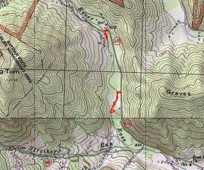
I started at the upper track on the map and began fishing my way downstream. There was a decent amount of cold 40° water in the river, given the recent rains. The river is narrow here, 10 – 15 feet), as you’d expect, as the valley opens up from the tight hills in the Park. Farther down, the river broadened to about 25 feet. The gradient at the upper end is fairly steep and moderates substantially the farther down you go. There are plenty of rocks in this stretch, creating a good trout habitat. The river bottom is all small rocks or gravel with a periodic large boulder poking through the surface of the water.
The depth is decent. In the upper section, the water was deepest, exactly where you would expect, as it collected in plunge pools formed by the high gradient. In the lower section I visited, it was more of a constant riffle with a max depth of a foot, except where the water had cut into the banks at the turns or where it dug out cuts around the larger boulders. In short, this was great water for nymphs or dries but lousy for streamers as they would be swept away before you could put them in action.
I fished both sections using nymphs as there was no hatch in progress or any bugs in sight on this cold December day. Even though I varied the depth in an attempt to drag the bottom, I did not have any success. Sadly, I did not see any fish at all. However, the water was a little bit murky based on the recent rains, so the lack of sightings is not a firm indication of lack of life.
Finally, there is not an overwhelming amount of brush to interfere with your movement downstream as long as you stay in the river. Once you leave, you are bushwhacking through dense undergrowth. There is no trail on either side which, hopefully, indicates a lack of fishing pressure.
Rose River Trout Fishing Bottom line: I spent two hours fishing in these two locations and would have spent more except that I took a stumble and broke my rod tip. This is definitely a place I will come back to when the weather warms up.
Given that the water temperature was under 45°, I had no illusions about the activity of the trout. It ends up being a random event (at least for me) to catch anything in water that cold.
But, I go back to the philosophical point made earlier that this section is not that far from the park so we should be able to see parklike attributes. If brookies can live in the park year round, then they should be here as well. The fact that the Rose River Farms fee fishing area maintains a population of trout all year round (although they prohibit fishing in the summer) seems to indicate that the water stays “cold enough” and would support a population of brook trout just like the park.
Getting There: From Syria, VA, continue north on Rt 670. It will turn into an improved dirt road. The southern spot on the map above is marked by a clear cut in the trees where a side road leads the short distance to the river. The northern spot is where 670 crosses the Rose.
Google Local Coordinates: 38.510363,-78.356295
Secrets Revealed? No. This is a very public location that is documented in the following places:
Virginia VDGIF
Fly Fishing Virginia
Flyfisher’s Guide to Virginia
Virginia Trout Streams
Virginia Blue-Ribbon Streams
Date Fished: 12/18/2008
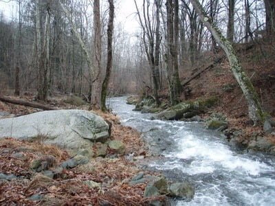
Downstream from northern track entry point
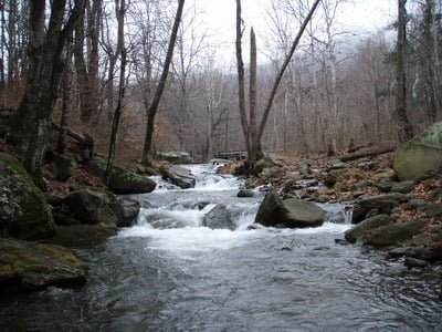
Upstream looking back to the bridge – northern track entry point
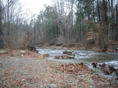
Upstream from southern track entry point
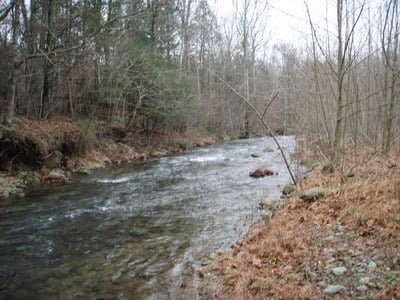
Downstream from southern track entry point
Unless stated otherwise, this article was authored by Steve Moore
