Since I was cruising around on the west side of the Shenandoah valley, I decided to go up and visit the Staunton Reservoir. I’ve fished downstream into the delayed harvest area below Elkhorn Lake but had never penetrated to the reservoir itself.
I was stunned when I drove up to the reservoir and peered into the spillway. It was almost dry. There was a thin trickle of water entering the North River that instantly disappeared into the rocks below. Clearly, the drought situation we experienced this summer was substantial and significant.
Unlike many of the other lakes in the George Washington National Forest, you cannot use a boat on the reservoir. The only place to fish is from the shore. Given that the parking lot is approximately 40 yards from the reservoir with a steep hill separating the water from the lot, it would be a tough drag to pull a canoe or kayak up to the water’s edge. That said, it’s a shame they do not allow people to drop in float tubes or pontoons since they would be easier to carry.
The fishing from the shoreline is exceptionally limited. There’s a short burst of accessible shoreline near the dam that extends approximately 20 yards west and then transitions into a beaten path that works around the lake to the other end. However, given the dense brush that clings to the steep shoreline, access is limited to a few places were anglers have trampled paths down to the lake’s edge. Do not bother to bring fly gear here since there is absolutely no room for a backcast. Spin and bait fishermen will do well to the extent they can throw their lure out into the center of the lake. In particular, the right-hand side of the lake clings to a steep hillside and you risk your life if you attempt to fish from that angle.
Staunton Reservoir Trout Fishing Bottom Line: During the summer, there will not be many people here as most of the population comes during trout season.
Getting There: Take S.R. 42 to the south end of Bridgewater, turn right just after the bridge, onto S.R. 727. Go west 3.3 miles to a “T” intersection with S.R. 613. Follow S.R. 727 to the left and go another 2.6 miles to the intersection with S.R. 730. Turn left onto S.R. 730 to Stokesville. At Stokesville, turn west onto S.R. 718 and continue one mile to the intersection with Forest Development Roads 95 and 101. Turn left onto FDR 95, follow past Todd Lake Campground; road is gravel from this point. Continue another 4.6 miles to the intersection with FDR 95B. Turn left and drive to the dam.

Secrets Revealed? No. This is a very public location that is documented in the following places:
Virginia VDGIF
Flyfisher’s Guide to Virginia
Tell a friend about this article by clicking on this link
Date Fished: 9/14/2010
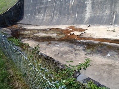
This is all that was coming out of the lake

Stagnant pools
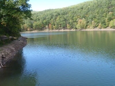
Southern edge of lake
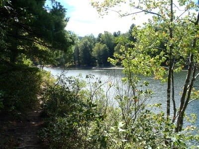
Looking to northwest
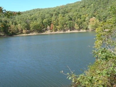
View to north

Dam
Unless stated otherwise, this article was authored by Steve Moore
