

This wraps up my coverage of the Pedlar River until next year. I was happy that I was able to visit all three of the access points to the delayed harvest area below the reservoir on the same trip in early April. Just like the other two, the turn into the northernmost delayed harvest access point is well marked. What the sign doesn’t tell you is to you need to be exceptionally careful if you’re going drive all the way to the parking area in a normal flatland car. It’s not that the road is exceptionally rutted, it’s that there are several humps that, if you’re not careful going over, you’ll scrape bottom. Take it slow and be alert so you don’t bottom out and leave your muffler on the road.
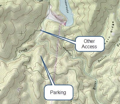
Pay careful attention to the map posted at the kiosk when you arrive. Chances are this will be the first access point you will use to get to the delayed harvest area since it is the closest to civilization. The map shows your current location as well as the other two access points. The key thing about the map is that, when you look closely, you will see that there is another access point farther north, outside of the delayed harvest area, that allows you to cover the upstream portion without the strenuous hike you’re about to undertake. Therefore, when you get to the bottom and enter the river, head downstream instead of going upstream since movement in that direction takes you closer to increased pressure.
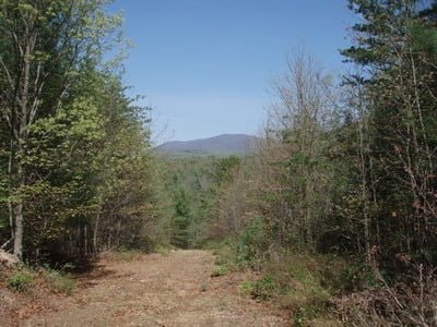
After you park your car, walk through the gate and onto the wide road that leads to the river. The first part is reasonably level with a gradual downslope but, like the path at the middle access point, it takes a sharp turn downward and drops quickly to the river below. I strongly encourage you to forgo fishing in this location unless you are prepared to climb back up at the end of a hard day. If you fish downstream, you continue to go downhill; adding to your climb to get back to the truck. Therefore, exercise caution based on your personal level of physical conditioning.
Once you walk the third of a mile and drop 204 feet to get to the river’s edge, you end up on old forest road 39E. This road, while overgrown, connects all three of the delayed harvest areas. If your intent is to have a backcountry experience, the road is the ideal trail to use to get away from the high pressure around the three access points. However, I don’t think you need to worry about pressure at any of these locations as a result of the short, but strenuous, hike to reach the river.
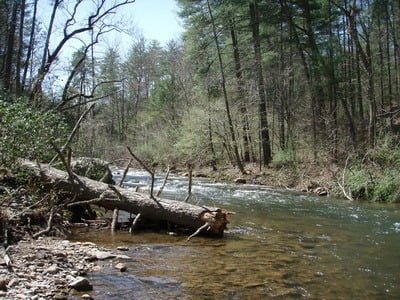
Recognizing the situation, I decided to move downstream when I hit the river and struck gold. Be sure you fish the broad pool 50 yards downstream from where the parking lot trail joins the river. The first pool is heavily stocked since the road from the parking area to the river’s edge is “stock truck compatible” all the way down. While trout will tend to migrate downstream within a week after stocking, they will hold in this pool until that migratory urge is triggered. Therefore, this is the place to target if you pay attention to the stocking schedule. In fact, when I was here in early April, I was able to stand in one place — by the fallen tree — and pick up five trout, one after another, on a green beadhead bugger. As a result of the success on the green bugger, I did not try nymphs when I was here.
Beyond that pool, the river takes a sharp turn to the left at a cliff and runs down a steep grade in a torrent. Even at the bottom, it remains narrow and fast and difficult to fish. Just like farther downstream, the river runs over across a rocky bottom with the key difference here being that the long shallow stretches are replaced by deep, deep pools.
Pedlar River Trout Fishing Bottom Line: The entire delayed harvest section of the Pedlar River deserves a trip at least once a year prior to the expiration of the delayed harvest restrictions. There are plenty of fish stocked into this section of river and, given its remoteness, makes for a beautiful day in solitary fly fishing in a backcountry environment.
Getting There: Follow Route 60 from Lexington over the mountains and into the valley. Turn right on Panther Falls Road. It will turn into FR 315 (do not turn off to Panther Falls). It will turn into Reservoir Road towards the dam. Stay on Reservoir until you see the first sign for the delayed harvest area
Google Local Coordinates: 37.663032,-79.284768
Secrets Revealed? No. This is a very public location that is documented in the following places:
Virginia VDGIF
Flyfisher’s Guide to Virginia
Tell a friend about this article by clicking on this link
Date Fished: 4/6/2010
Initial trail – pretty easy
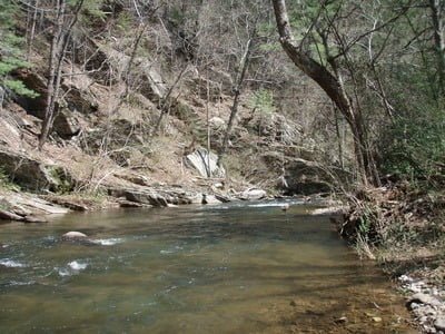
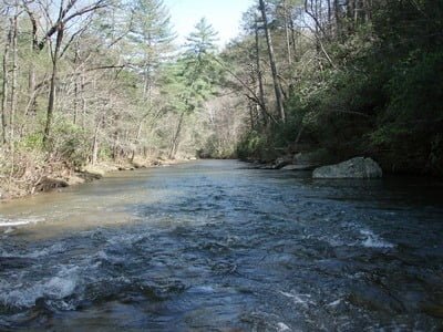
View upstream from entry point at end of the trail
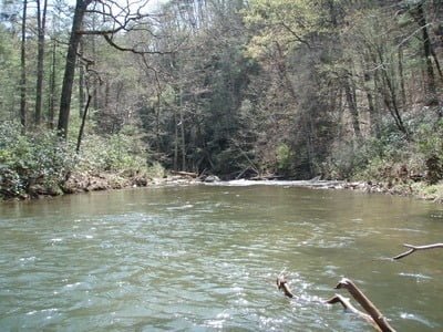
View downstream from entry
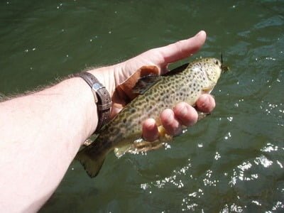
Plenty of these guys swimming around
End of the first deep pool. Stand next to the tree you see at the lower right of the picture
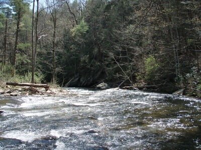
River runs sharply downhill at this cliff.
Levels out again after the drop and remains fast.
Unless stated otherwise, this article was authored by Steve Moore