The Pedlar is a great-looking, long river that runs down the eastern side of the Blue Ridge. There’s no easy way to get here from Northern Virginia. It’s a long haul whether you come from the east or west. Thankfully, the trip is worth it. The Pedlar presents several choices. You can work it off FR 39, FR 135 or even down below the dam. On this day, I worked FR 39 and the South Fork of the Piney in the morning and then hit the section off FR 135 on my way back out.
After winding down a steep dirt road and bumping into the unmarked parking lot, I loaded up and looked for the trailhead to the river. As you can see from the map on the right, neither the road nor the trail to get here are marked but don’t sweat it. Both end up being pretty obvious. Once on the trail, you walk 75 yards down a shaded path sheltered by pine and other trees to the river.
There is no defined trail on the west bank where I hit the river, so I waded across at the entry point. It’s an easy wade, but it’s pretty shallow right here. As I looked up and downstream, I debated which way to go, quickly deciding to work my way down as I could see a cliff formation in the distance. That usually means a turn in the river and a nice deep pool.
Once across, I discovered a small game trail that allowed me to move quickly with minimal pricker bushes lunging to put a new hole in my waders. The ground is level, and I found the walking as easy as it was fast. Sure enough, the cliff formation uncovered a nice bend in the river with a tree thrown casually across to add interest.
I worked my normal copper john with a pheasant tail dropper, slowly drifting them on the seams next to the bank and the tree. On about the 5th pass-through, the indicator jerked to the deck. Startled, I yanked back and was rewarded with a struggle. This guy was alive! It took all I could to keep his head out of the tree. I worked him back into the main push of the current, slowly walking downstream to keep from snapping the 6X tippet I was using. After a few minutes, I had him. Nice fish. I plopped him back, and then I moved on.
Beyond the cliff, the Pedlar opens up with the spread, producing a shallow, slower flow that begged for terrestrials. I picked up a few additional smaller trout – enough to keep me interested until it was time to go. As you can see from the pictures, there are plenty of large rocks and other structures to shelter trout and more than its fair share of overhanging trees to snag a random fly or three.
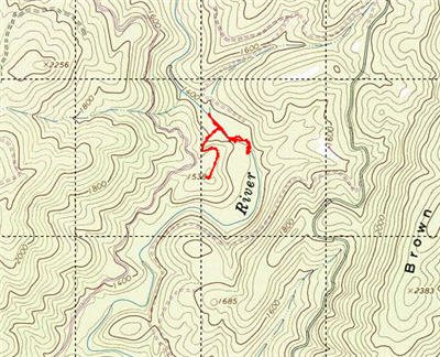
I only spent about two hours here because I also wanted to look at the South River and Irish Creek for late afternoon fishing. With regret, I hiked back up the gentle 75 yards to the parking lot. However, I need to share a word of caution. Where the trail hits the river is not obvious. You need to either mark it as a waypoint with your GPS or really mark it well in your mind. Otherwise, you will miss it as you walk back up the river.
Pedlar River Trout Fishing Bottom Line: This is a wonderful little river. It is as remote as a river can be in this part of Virginia. I never felt close to civilization. While I did not see anyone the day I was here, the medium sized parking lot indicates that there is a reasonable amount of pressure on this stretch. The Pedlar gets a number of stockings and enjoys a delayed harvest section below the dam. This section and the FR 39 section have no restrictions.
There are decent trout here. I regret that I did not go all the way to Panther Falls and work that section. In fact, I also regret that I did not go to the delayed harvest section below the reservoir as well. Another trip for another day!
Getting There: It’s a long drive from the Northern Virginia area – probably a good 3.5 – 4 hours. Just follow 81 down and take Rt 60 through Buena Vista. Go past the entrance to Skyline Drive at the top of the hill and take an immediate right on the road to Panther Falls. It’s the first turn after the parkway. Go all the way down the hill on the dirt road and then take a left into the parking area. You will be able to see it up the short road from the dirt road you followed down. At the eastern edge of the parking area, you will see the trailhead.
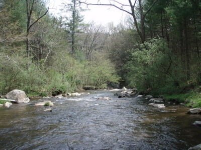
View downstream from where the trail hits the river
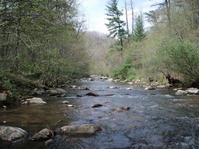
View upstream from where the trail hits the river
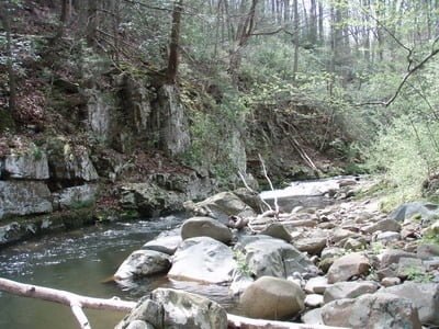
First nice hole working downstream – great for nymphs
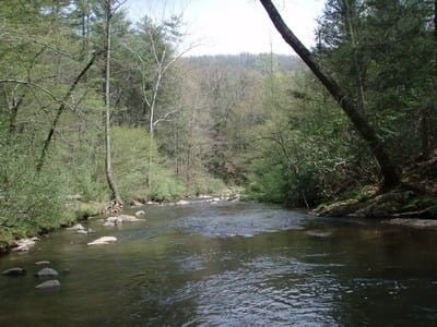
Water pools a bit farther down
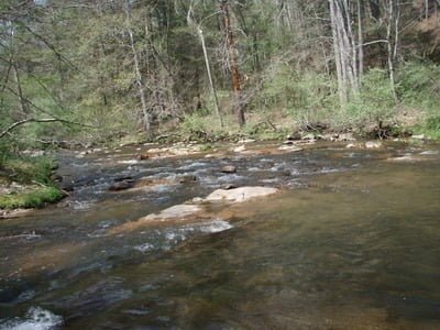
Some sections look flat, but are actually pretty deep
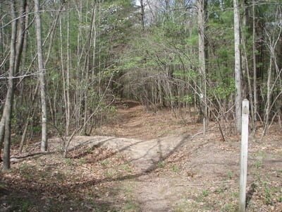
Trailhead at the parking lot
Unless stated otherwise, this article was authored by Steve Moore


