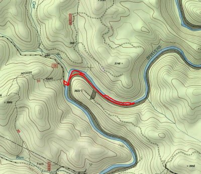
It was cold in mid-October, with the air temperature pushing 45° as I bumped down the rough road into the Shavers Fork of the Cheat on FR 210. There are three primary access points to the Cheat River, and FR 210 is at the northernmost. This location marks the start of the catch-and-release special regulations area that runs from here all the way upstream to the FR47 access point.
After looking up and down the river – and being impressed with what I saw – I decided to walk downstream for a mile, heading out of the catch and release area, given my preference for working upstream. In addition, I doubt anyone who ventures this far into the backcountry would be interested in slaughtering and hauling out a bunch of fish. The rail bed that parallels the river (exactly like the North Branch of the Potomac) was the high-speed avenue of approach I used to move quickly. As I walked, I kept a wary eye on the river to try and uncover the specific locations that would be better than others. The structure of the bottom alternates between being densely packed with rocks and boulders to transitioning into flat, seamless, barren, solid expanses of rock. I knew from prior experience that a flat bottom, void of cover, is not the place where you will find trout. It’s the trout equivalent of a sandy bottom for bass. Marking the good spots in my mind’s eye, I eventually climbed down the steep grade and popped into the water.
I entered the water at a gradient break with a high-velocity churn of boiling water that spun into a deep, dark hole. Nervous with excitement, I rigged up a couple of nymphs and flipped them into the current. After several casts trying the nymphs at various depths, I finally hit on the right combination and began to catch a fish or two. Once I concluded that I had spooked the pool, I turned my attention upstream to the flatwater area that fed into the gradient break. I had one of my few rare good casts and watched as the nymphs and the indicator settled gently in the water and started their way downstream. I almost lost my balance when a big trout slammed into the bright green indicator!
This happens to me enough that I sometimes think about tying a hook to the indicator. Concluding that this action meant that the trout were beginning to feed on top, I switched over to dries and peppered the flat pool with a bright green grasshopper — hoping that it was not too late in the season for terrestrials. No joy, so I turned my rod upstream to see what it had to offer. I skipped around a huge flat, rock ledge and walked upstream to fish the boulder area above it. I tried to work dry fly magic with no success, so I switched back to the same nymph rig I had started the day with. I picked up one fish; nothing to brag about and certainly nothing worth taking a picture of.
Looking upstream, I could see the great character of the river continued with broad, rocky, good banks that supported rapid upstream movement on the side opposite the rail bed. In fact, the river was wide enough to make me wish I’d brought my 6wt rod to punch line farther out into the current. While not as tough as the North Branch, the boulder strewn shoreline made it challenging to move quietly on the bank without knocking rocks.
Shavers Fork of the Cheat Trout Fishing Bottom Line: This was my first experience on the Cheat River and I ended the morning happy and satisfied. I could see that on a summer or spring day with the water temperature a little warmer than the 42° it was running in October, that this would be a fantastic place to visit. Thrilled that I had discovered a great new fishing location, I climbed back in the truck and bounced my way back up to the main road to head down to the next access point on the Cheat.
Getting There: Locate the town of Durbin, WV. Head north on US 250 and be alert for the bridge over the Cheat River. About 3 miles from the bridge, turn right onto PR 92. It runs up a ridge and the access points to all of the Shavers Fork spots are turns to the right from this road. Follow the road until you see the sign for FR210 and follow it to the river. Google shows this as an extension of FR190 and does not identify it as a different road.
Google Local Coordinates: 38.705339,-79.838333
Secrets Revealed? No. This is a very public location that is documented in the following places:
Flyfisher’s Guide to Virginia
Mid-Atlantic Budget Angler
Tell a friend about this article by clicking on this link
Date Fished: 10/14/2009

Large well-marked parking area

The view upstream from the access point (east end on the map)
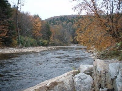
View downstream from the access point

Great pools scattered along the length of the river
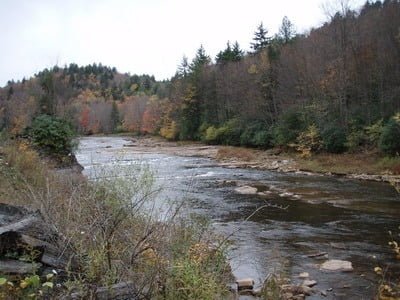
View upstream from the tracks showing the better bank for access is on the north side of the river
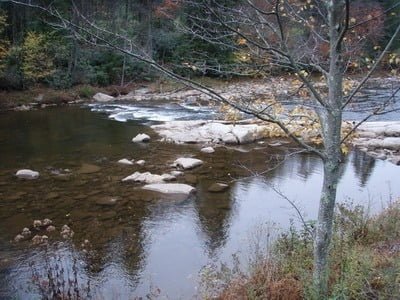
Typical pool/rock/boulder area
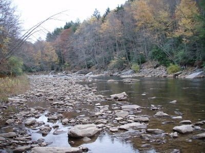
Easy walking at the bend in the river
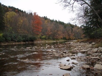
Great structure – all these rocks shelter fish
Unless stated otherwise, this article was authored by Steve Moore

