I bumped down the dirt road — Forest Road 47 — that led to the lower boundary of the Shavers Fork of the Cheat catch and release area. This road was much easier to navigate than the ones that led into the other two access points farther north. There were fewer potholes, and it would be easier for a normal “flatland” car to get in here. The parking lot at the end is broad and improved with the standard sign marking it as a catch and release area. One thing the sign did not specify was that this was the lower boundary, making it a little confusing to know which direction to fish to enter the protected zone. There is another sign that you can see from the parking lot on the far bank of the river. I was surprised that there was not a cable stretched across the river as there was at the northern end.
That said, I was not interested in keeping anything anyway; rather, I just wanted to catch some fish.
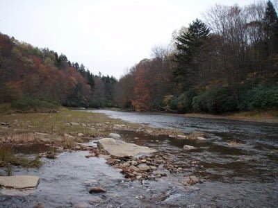
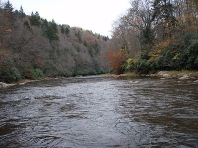
The most remarkable thing about this section is the alternating flat ledges and boulder-strewn areas, which are so noticeable downstream that they are absent here. For the entire distance, I walked upstream, the bottom was all rocks and boulders — perfect habitat for trout. The only concern is that the river was broad and ran shallow in many areas. To fish this properly, you have to identify the seams. Putting that guidance to good use, I started to look for those areas where the water was just a little bit darker, indicating more depth. Based on my experience earlier in the day downstream, I used a nymph and drifted it through the slots. Nothing!
I continued upstream for almost a mile and could see the rail bed in the distance when I decided to call it a day and turn around. I had fished each seam diligently without a single strike or, in fact, seen a single fish. However, that structure is so ideal that I’m sure there must be plenty of fish that will be more active when the water warms up and the weather is better.

Shavers Fork of the Cheat Trout Fishing Bottom Line: After checking this last major access point to Shavers Fork, my single vote, unanimous conclusion is that this is a great place to fish. I’m sad to realize that exploiting this water will involve an overnight trip for me from Northern Virginia. Rats! The opportunities to get away overnight are few and far between. I need to work on creating that future!
Getting There: Locate the town of Durbin, WV. Head north on US 250 and be alert for the bridge over the Cheat River. About 3 miles from the bridge, turn right onto PR 92. It runs up a ridge and the access points to all of the Shavers Fork spots are turns to the right from this road. Follow the road until you see the sign for FR47 and follow it to the river.
Google Local Coordinates: 38.663196,-79.86331
Date Fished: 10/14/2009
Secrets Revealed? No. This is a very public location that is documented in the following places:
Flyfisher’s Guide to Virginia
Mid-Atlantic Budget Angler
Tell a friend about this article by clicking on this link

Well marked parking area

Upstream from the entry point

Downstream from the entry point

Looking back to the parking area
Unless stated otherwise, this article was authored by Steve Moore


