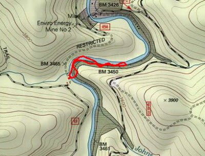
FR 49 is the road leading to the middle access on the Shavers Fork. It’s in the heart of the catch-and-release section and parallels Crouch Run on the way down to the river. There are two places you can park when you get down to the bottom. The first is at a sharp turn, where the road cuts right to run along the river. If you park in the first place, be cautious about driving all the way down to the bottom of the hill at the turn. The road is heavily rutted, and you will need a four-wheel drive vehicle to get back up, especially if the ground is slick. Alternatively, you can continue another quarter mile down the road to the other access point. Both of these have limited parking — there is room for one truck at the first access point and perhaps two at the second.
I popped out at the first access point, skidded down the hill to cross Crouch Run, and entered the river at a sharp bend. Like the northern access point near McGee Run, the bottom of the river is a perfect trout habitat. It’s full of rocks and boulders and, on this day, was relatively easy to wade across with the depth averaging between 2 and 3 feet. Once across, I walked on the rail bed, heading downstream to get a better sense of the river. I discovered that, just like the northern access point, the river alternated between having a boulder-strewn bed and flat rock ledges devoid of life.
When I had decided I had moved downstream far enough to walk away from any imagined pressure, I began to fish my way back. Capitalizing on the intelligence I gained at the McGee access point, I continued to use a nymph rig and picked up a fish or two. The action was not hot and heavy, but at least things moved slightly in the frigid 44° water.
As I was fishing, I heard the rumble of a train approaching and was surprised to see that the Cass Scenic Railway runs along the Cheat River. After waving at the engineer, I repeated that for the three carloads of tourists who had come to see the fall foliage and were probably startled to see a crazy man standing in the river on a freezing day fly fishing.
With the excitement of the train over, I continued to fish my way back to the sharp curve immediately downstream of the access point, I found a great channel where the water spilled across many huge boulders and created a deep spot that stretched for 20 to 30 yards. After a cautious approach, I began to plumb the depths with nymphs. It took some trial and error to find the proper depth setting, but eventually, I got the nymphs to the bottom and successfully pulled in a small rainbow.
Since the water looked so good here, I switched to dry flies in the hope of getting some top-water action, but I was disappointed. I continued to fish with dry flies on the way back to the access point.
After fishing in the first spot, I hopped back in the truck and bumped down the road to the other access point. Immediately in front of the parking area is a very deep pool punctuated by rock ledges that push their way out into the stream. I can imagine people sitting here in the summer sunning and having a good time fishing. I took a short walk upstream along the path that parallels the river on the west bank and noted the same mix of rocks and ledges persisted into this location. Since I had a limited amount of time, I did not fish this stretch… except in my imagination.
Shavers Fork of the Cheat Trout Fishing Bottom Line: Another great location on the Cheat River that deserves a return visit.
Getting There: Locate the town of Durbin, WV. Head north on US 250 and be alert for the bridge over the Cheat River. About 3 miles from the bridge, turn right onto PR 92. It runs up a ridge and the access points to all of the Shavers Fork spots are turns to the right from this road. Follow the road until you see the sign for FR49 and follow it to the river.
Google Local Coordinates: 38.677369,-79.842303
Secrets Revealed? No. This is a very public location that is documented in the following places:
Flyfisher’s Guide to Virginia
Mid-Atlantic Budget Angler
Tell a friend about this article by clicking on this link
Date Fished: 10/14/2009
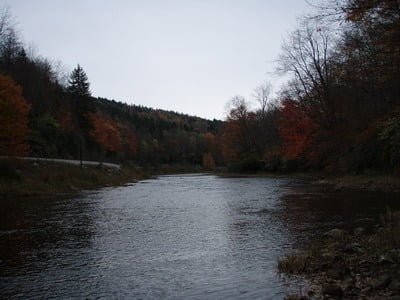
Upstream from the access point
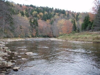
Downstream from the access point
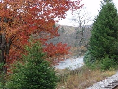
River peeking through great fall foilage
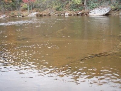
There are “dead zones” of flat rocks
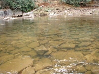
Plenty of great spots like this!
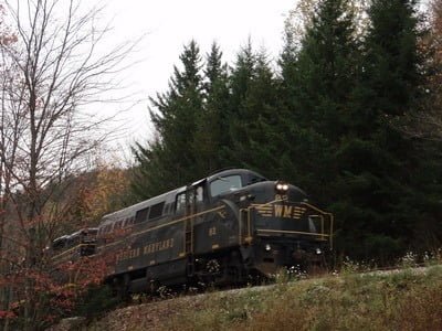
Wave to the tourists!
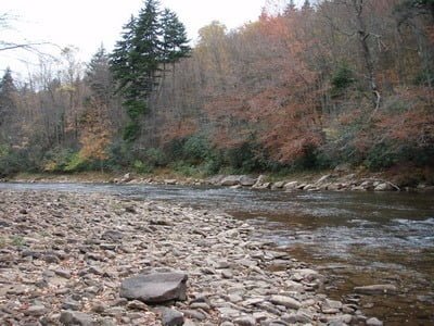
The view into the bend near the access point. Great channel on the right.
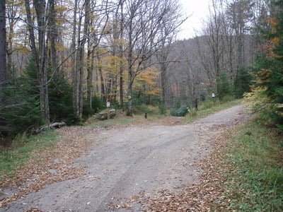
This is all the parking available at the access
Unless stated otherwise, this article was authored by Steve Moore


