Approximate Boundary:
39.188903,-77.004898 to 39.167557,-76.998242
Below the Brighton Dam, the Patuxent River offers up a marginal tailwater fishery but… it is a tailwater. The fishery is limited in the sense that, during the summer, not enough cold water is released from the Dam to keep the water chilled and crisp to the optimum levels for trout survival. The good news is that there is a dense thicket of trees that lean into the center of the river, throwing a protective canopy over the water blocking a significant part of the heat associated with a typical, scorching Maryland summer. In a good year, the trout will survive and actually reproduce.
In general, the stream is low gradient with no significant drop in elevation as it meanders through the forested valley leading to the bottom of the section at Mink Hollow Road. The river bed is mostly a sand/gravel mix with clay and mud making wading a challenge along the banks. However, there is plenty of good structure clustered around the shore as a result of the numerous fallen trees that complement the natural twists and turns creating holding areas for fish. In addition, some sections feature dramatic rock cliffs that usually mark the location of a deep pool.
This is not a wide river. It ranges in width between 10 and 40 feet with random wider spots. The joy of fishing here stems from the fact that the Potomac-Patuxent Chapter of Trout Unlimited routinely float stocks the river. Their public service allows fish to be evenly distributed into the best habitat available. That, coupled with the cold water, extends trout survival into the summer months with some holdovers.
Fair warning! Nature conspired to protect the banks. The banks are either exceedingly steep or densely wrapped in pricker bushes that take great pleasure in peppering your waders with an infinite number of micro-holes. In addition to taking a fly rod, carry a small pair of garden shears to cut your way to the bank.
Although poachers ignore the fly fishing only regulations at their own peril, this remains a good section to fish. There are three primary access points:
• Immediately below the Dam
• Havilland Mill Road
• Mink Hollow Road
The first 400 yards downstream of the Dam is easily accessible and open to all types of fishing If you decide to enter the river from the Brighton Dam access point, be aware of the hours! The gate that provides the only access through the high chain-link fence is managed by the Park Ranger whose office perches at the edge of the parking lot. Don’t stay late or you may be locked in. The other two access points are associated with turnoffs from the road and do not have that restriction.
If you start fishing at Brighton Dam, there is a small path on the western bank of the river that follows the stream. It leads along the bank and provides reasonably easy access to the river for the first 0.5 miles. In this section, the river bed is mostly sand with periodic sections of muck that makes wading difficult. It is deep enough to require chest waders. As you fish, focus on the water under the overhanging trees and thick bushes. In most cases, the root complex associated with that vegetation caused the river to carve out a deep hole providing a good holding spot.
At the Havilland Mill access, walking is easy in either direction from the small parking area. There is a thin trail paralleling the river that provides a good vantage point to peer into the water from the high banks. The initial bends feature high rock walls with a calm, still pools that attracts plenty of fishing attention.
Mink Hollow continues the trend of high bank and deep water with the added attraction of huge carp. The parking area only supports two or three cars on the shoulder on either side of the bridge. There is a narrow trail on the eastern bank that runs between the water and a fence that marks the boundary of private property. The bottom continues to be a sandy with even more fallen logs than upstream. The water stays deep, almost unwadeable, until the river splits west at 39.17508, -76.99811. At that point, it runs down a minor gradient and rocks begin to predominate with easier wading upstream.
In summary, the Fly Fishing Only stretch features a tight river that has the potential to holdover the carefully stocked trout and is well worth the time to fish.
Patuxent River Trout Fishing Access Points:
Brighton Dam 39.191808,-77.005924
Havilland Mill Road 39.178491,-77.000005
Mink Hollow Road 39.167557,-76.998242
Tell a friend about this article by clicking on this link
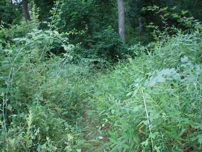
Dim trail parallels the river from the dam
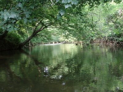
Fishing is tight
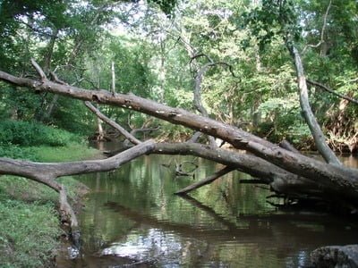
Plenty of good looking structure to hide fish
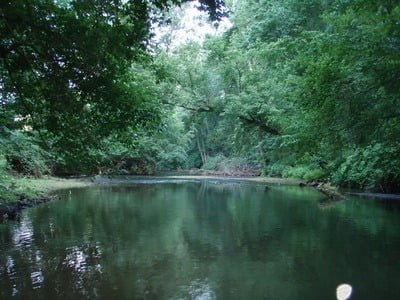
The river ranges from 10 to 40+ feet wide
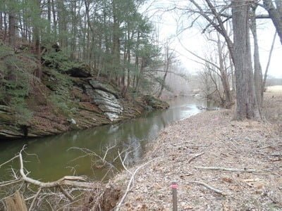
Farther downstream, rock walls pop up at bends
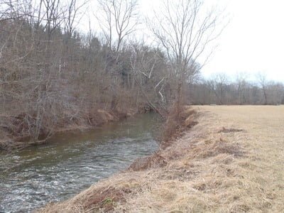
Steep banks become a challenge at Haviland Mill
Unless stated otherwise, this article was authored by Steve Moore
