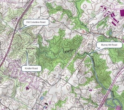
The Middle Patuxent River delayed harvest area runs for 2 miles downstream through Gorman Park from US 29 to the bridge that supports Murray Hill Road, approximately a mile east of I-95. On the other side of I-95, it bubbles downstream to merge with the Little Patuxent River just east of Savage.
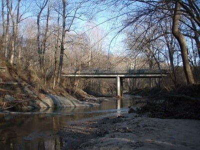
There are three primary access points to the river. Starting from the west, pull off on Old Columbia Road and follow it to the river crossing. There is a limited amount of parking near the river. The second is at the end of Kindler Road in the heart of Gorman Park. While the map shows the road going all the way to the river, it is gated a quarter mile from the river. This is your best bet and easiest access point to use. The last and worst access is off Murray Hill Road, where you must park on the narrow shoulder. The boundary of the public area is clearly marked by prominent “No Trespassing” signs on the downstream side of Murray Hill Road.
Despite the fact that it is in the center of a heavily populated area with major roads within a short distance on four sides, it is easy to feel isolated as you walk along the high riverbanks. You can see houses in the distance on the northern bank, but the southern bank runs mostly through a heavily wooded area. Those trees are key to trout survival while they are in the water. They throw a considerable amount of shade and serve to keep the temperature down. Unfortunately, the trout disappear quickly at the conclusion of the stocking season when the water warms up. Thankfully, there are a few bass mixed in that normally inhabit the deeper pools to provide fun throughout the summer.
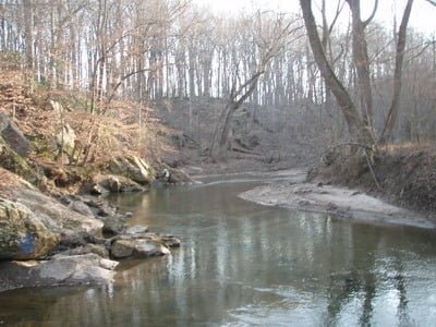
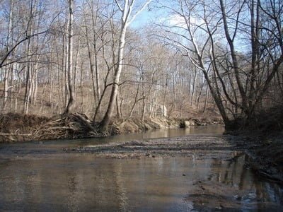
While there are exceptions to every broad statement, the river itself is generally unremarkable as it drifts lazily downstream with very little change in elevation. It has a mixture of rock, gravel and sand with sand being constant near the Kindler Road access point while rocks predominate on the eastern end near Murray Hill Road where the terrain tightens and compresses the river between high ridges. Do not be discouraged by its narrow presentation at either end since the river spreads out to over 40 feet in width near Kindler. Each bend in the river usually holds a larger pool that provides the best shelter for the huddled fish. In fact, the best tactic is to ignore the shallow runs that connect the bends and focus on the bends themselves unless you encounter a pool in the middle.

In the past, the river has been float-stocked by the Potomac – Patuxent chapter of Trout Unlimited. Hopefully, that will continue into the future since it is the only way the fish will be evenly distributed across the two-mile length of river.
Middle Patuxent Trout Fishing Access Points:
Old Columbia Road: 39.168177,-76.883233
Kindler Road: 39.161988,-76.879027
Murray Hill Road:39.159925,-76.852291
Tell a friend about this article by clicking on this link

The lower end near Murray Hill features steep ridgelines and deep pools

Murray Hill bridge – park on the shoulder to the right

Upper end at Old Columbia Road… almost parklike

Most of the river runs flat and slow across sand at Kindler
Unless stated otherwise, this article was authored by Steve Moore


