Approximate Boundary: 39.134454,-76.816413 to 39.1489,-76.832721 (2.06 miles)
DNR Guidance: Little Patuxent River from US 1 upstream to Vollmerhausen Rd
The Little Patuxent River is a stream that offers two remarkably different fishing experiences. If you fish near Savage Mill, you will be shoulder-to-shoulder with hikers, picnickers, and far more anglers than you can count. However, if you move upstream and park in Savage Park, the short walk to the river provides enough physical obstacles to reduce pressure to almost nothing. Hikers and bikers will still cruise by on the improved trail, but the density of anglers drops dramatically.
At Savage Mill, you may as well start fishing immediately since everything will be crowded until you walk north of the confluence of the Middle Patuxent River. As a result of the additional water contributed by the Middle Patuxent, the section downstream from the confluence to the Mill is wide and features plenty of gradient drops, glides, and deep pools. The river runs over a rocky bottom with plenty of sand and is around 30 to 50 feet wide.
There are trails on both sides of the river from the mill, the most popular one being the Savage Mill trail, which runs along the southern bank. The stream has a western Maryland appearance based on the number of large boulders strewn across the stream framed by tall trees on either side. There are periodic fallen logs to create additional interesting fish-holding structures. Although the banks are high, they are set back from the edge of the water far enough to avoid creating a problem. You can easily move along the shoreline by dancing across the jagged rocks that line both sides of the river. The most heavily fished area is the one below the small waterfalls a few hundred yards upstream from the Mill. If you venture all the way up to the confluence, be sure to fish the good pool adjacent to the concrete panel that lies within the first 100 feet of the Middle Patuxent upstream from the junction.
If you don’t mind hiking 150 yards down a steep hill, park at Savage Park and take the trail to the west. Upon reaching the river, you will find yourself on a high bank that guards a long calm pool. The path in either direction is level and easy to walk. There is no advantage in moving up or downstream given the heavy pressure the entire river complex experiences, so start fishing right away. However, the 150 yard investment you made separated you from the worst of the pressure downstream. The river is narrower and ranges up to 20 to 30 feet wide but exhibits the same bottom structure with plenty of rocks surrounded by sand. As a result of the steep hills that cradle the river, the water flows through deep channels around boulders with periodic shallow areas where it is allowed to spread out. At normal Spring water levels, the river runs around 2 feet deep and is easy to wade. While the banks are high all the way down to the confluence with the Middle Patuxent, they gradually moderate and blend in with the stream as you move north toward Vollmerhausen Road. The density of rocks increases upstream, but there is still plenty of sand. The better pools are closer to the northern boundary of the stocked section. However, be aware of private property in that area.
Getting There: From I-95, take the exit onto MD 32 E. Take exit 12 for US 1 toward Laurel. Stay right to remain on US 1 S/Washington Boulevard. Turn right on Gorman Road. Turn right on Foundry Street.
Options include:
· Park near the bridge to access the Savage Mill stretch.
· To go to the access point in the park, go across the bridge and turn left on Baltimore Street. Turn right on Fair St and follow it into the park. Drive around behind the building and end up in the small parking lot at the trailhead.
· Continue on Foundry across the bridge to turn right on Baltimore Street. Turn left onto Savage Guilford Road. Turn left onto Vollmerhousen Road. From the parking lot, follow the Patuxent Branch Trail to the stream.
Access Point:
· Savage Mill on Foundry Street (39.134494,-76.824925)
· Savage Park parking lot near trailhead (39.140471,-76.830152)
· Patuxent Valley Middle School on Vollmerhausen road (39.147265,-76.829429)
Secrets Revealed? No. This is a very public location that is documented in the Maryland DNR stocking plan.
Tell a friend about this article by clicking on this link

View upstream from Savage Mill Trail
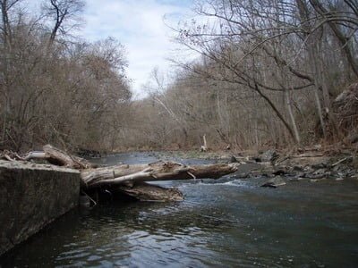
The good pool at the confluence
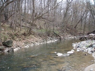
Water upstream into the gap by Savage Mill
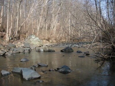
Water upstream after walking to the stream from Savage Park
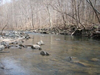
Rocks continue upstream
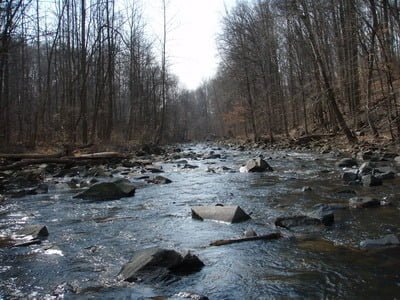
Higher gradient, more rock, shallow water
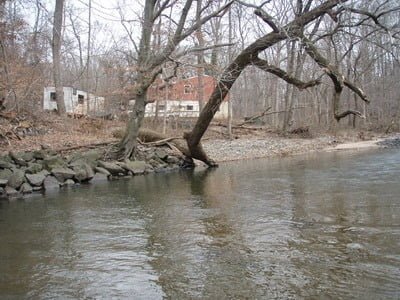
Private property at the top end – stay on the east bank
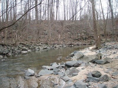
View downstream from top
Unless stated otherwise, this article was authored by Steve Moore

