The end of October is a desperate time for me as I try to balance good weather with dwindling fishing opportunities. It had been raining cats and dogs the week prior, but the weekend promised to be glorious and sunny. In anticipation of a final foray into the woods for fall trout, I convinced my wife that she had to visit her sister. After doing a “dump and run”, I headed the truck north through Baltimore on I-95. A quick turn onto Rt 24 took me to the Rocks State Park where Deer Creek is heavily stocked.
The creek had been stocked the week before, so I knew there would be fish. The only issue would be whether the water would be blown out from the rain. Sadly, as I drove around the first corner to run parallel to the creek, I was disappointed to see nothing but thick, brown sludge roiling downstream towards the Susquehanna. Oh well, I was here anyway, so why not do a thorough recon?
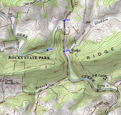
Forming an opinion without being able to see the bottom, I think Deer Creek looks like a pretty good stream. Extrapolating from my experience elsewhere in Maryland, I’m sure the bottom is sand and mud and the trout that are deposited here do not survive much beyond the stocking season. However, there is plenty of water to distribute pressure, and the road runs next to the creek for the entire distance. Unfortunately, few pull-offs exist for those who want to park near the river. There are parking areas at the points marked on the map and a few others randomly distributed along the stream, but not that many.
The Creek runs through a deep gash created by the dramatic split of Rock Ridge into two sections. One result is that the banks are steep with limited access points, and most will require a scramble to get down into the stream. Without having a sense of the depth at normal water levels, I can’t tell you which of the access points represents the best opportunity to wade and fish. Beyond that, the stream appears to be a normal Maryland creek along the lines of the Patuxent or Great Seneca Creek, except that it is wider and holds a greater volume of water. The largest turnout is near 006, where there is the trailhead for those who want to walk to destinations away from the creek inside the Park. The turnout at 002 is small, limited, and will only hold three vehicles. There’s a trail that follows the northern bank of the stream for a considerable distance moving west from that parking lot. All of the other locations require walking on the road to find an entry point into the creek.
A final point to make is that the creek appears to be easily fishable. While there are trees on the banks, they do not obscure the creek and will not interfere with casting. There are trees and logs that have fallen into the creek that provide obvious targets and holding structure for fish. In short, this might be a good place to teach somebody how to fly fish given the greater width of the stream and the lack of overhead obstructions.
Deer Creek Trout Fishing Bottom Line: Deer Creek is worth a return visit when the stocking begins again in the spring. However, if you live in the DC area, there are other, better places that are closer. My primary motivation to visit Deer Creek was the need to see a new place.
Getting There: From I95, turn north at exit 77 on MD 24 towards Bel Air. Follow it to the Rocks State Park. Start fishing as soon as you see the stocked water signs
Google Local Coordinates: 39.632167,-76.410985
Secrets Revealed? No. This is a very public location that is documented in the Maryland DNR stocking plan
Tell a friend about this article by clicking on this link
Date Fished: 10/25/2009
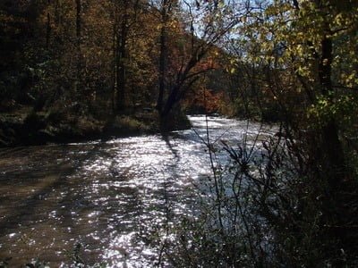
Downstream from point 006 on the map

Downstream from point 002 on the map
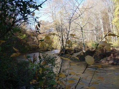
Upstream from point 003
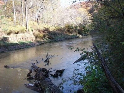
Downstream from point 003
Unless stated otherwise, this article was authored by Steve Moore

