
Approximate Boundary: 39.387188,-79.461551 to 39.500332,-79.415889 (12.63 miles)
Unless you fish from a canoe or kayak with a greater interest in paddling than fishing, do not become elated at the prospect of over 12 miles of stocked water. There are only a few accessible points for kayakers, the stock truck or wading anglers. Moving west, away from Oakland, the worse it becomes. At the start of the stocked section in the tiny village of Crellin, the river is a muddy, silty mess with little to recommend it. The river is wide and shallow consisting of high banks with scattered trees throwing some shade over the water. Since the river runs through town, a mix of residential and industrial buildings peppers the banks conspiring to create an unfriendly, unattractive vista. In short, not a compelling or pleasant fishing location.
Thankfully, by the time the river reaches the Liberty Street bridge crossing miles downstream, it is dramatically different. The bottom is now uniformly coated with a layer of rock with large boulders providing random points of interest, creating pools and holding locations. Access the river via the fisherman’s trail on the west side of the bridge. Rocks and boulders line the banks and hold back the vegetation. There are still plenty of trees to provide interesting scenery as well as a little bit of shade.
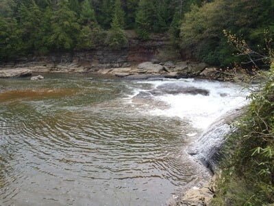
The next access point is at the Swallow Falls State Park. There is a small turnout, outside of the park (no fee), on the east side of the bridge. Only a fool would wade in the river downstream since Swallow Falls is only a short distance away. There is a trail leading from the parking lot to the north side of the bridge providing access to the upstream river. However, unless you are willing to walk over a mile, be prepared for a total waste of time. Upstream of the bridge, the river bottom consists primarily of a slick, flat rock shelf that holds no structure and prevents the creation of pools or the generation of forage to attract fish. In the far distance, you can see some large boulders poking up out of the streambed and those mark the first place where the fishing becomes acceptable. The flat shelf continues upstream until 39.486957,-79.408566 where rocks and pools take control.
If you walk across the street from the parking lot, follow the trail down the east side of the river to get a bird’s eye view of Swallow Falls and fish the downstream river outside of the danger zone. Exercise extreme caution if you choose this option and wear a PFD.
The Oakland section is the 25th most heavily stocked stream in the State.
Getting There: To go to the south end, follow MD 39 west from Oakland. Turn left onto Ottobein Street. Ottobein becomes Kendall Drive. Turn right on Crellin Underwood Road.
To go to the north end, turn west onto S Center Street from US 219 in the center of Oakland. Continue onto N Bradley Lane. Turn right on Liberty Street. Liberty becomes Herrington Manor Road. Turn right onto Swallow Falls Road. Park on the east side of the bridge over the river.
Access Point:
· Parking area on the east side of Crellin Underwood Road north of the junction of Snowy Creek with the river (39.38778,-79.463742)
· Parking lot of the baseball field just south of Snowy Creek (39.38606,-79.462529)
· Junction of MD 39 and Ottobein Street (39.391039,-79.463801)
· Bridge crossing on Liberty Street (39.424158,-79.421808)
· Bridge crossing at Swallow Falls Road (39.494247,-79.416273)
Secrets Revealed? No. This is a very public location that is documented in the Maryland DNR stocking plan.
Tell a friend about this article by clicking on this link
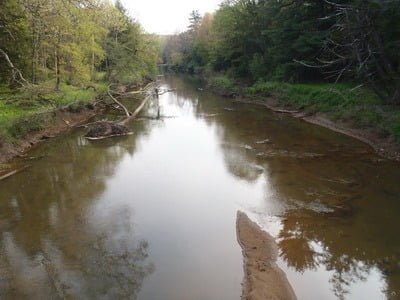
Near Crellin
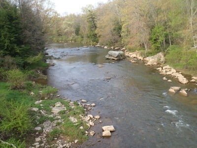
Liberty Street Bridge Upstream

Swallow Falls Upstream

Swallow Falls Downstream
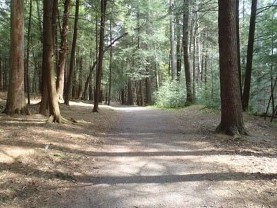
Path into park to the falls
Swallow Falls area
Unless stated otherwise, this article was authored by Steve Moore