

Approximate Boundary: 39.543268,-79.138516 to 39.603043,-79.167831 (5.11 miles) Big Run drops 1,162 feet as it wanders 5.1 miles from its source on the south side of Meadow Mountain through the gap between Middle and Peapatch ridges. Given that huge drop, Big Run meets all expectations associated with a high gradient stream and pairs up with its major tributary, Monroe Run, to be the key water feature inside Big Run State Park.
The DNR stocked almost 17,000 brook trout in the 40 years between 1948 and 1988 to reestablish their presence. Like the rest of the Savage Reservoir watershed, is protected by a Zero Creel fishing regulation.
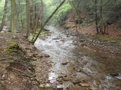
The name “Big Run” recognizes the width of the stream rather than its depth. In most places, the shallow stream runs 15 to 20 feet wide across a rocky bed. Given the sharp drop in elevation, anglers must hike to find pools deep enough to fish. Most of the park facilities, including improved campsites, restrooms, and a potable water source, are located at the junction of Big Run Road and Savage River Road.
Getting There: From Westernport, take MD 135 west towards Bloomington. Turn right onto Savage River Road. Turn left on Big Run Road.
Access Point: Various turnoffs and campsites adjacent to Big Run RoadSecrets Revealed? No. This is a very public location that is documented in the Maryland DNR website.
Tell a friend about this article by clicking on this link

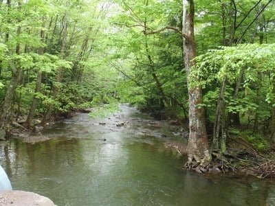
Shallow glides lead to…
deeper pools
Easy access off of Big Run Road
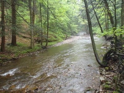
You have to walk a bit to find the better spots
Unless stated otherwise, this article was authored by Steve Moore