Approximate Boundary: 39.566646,-77.495044 to 39.565645,-77.496057
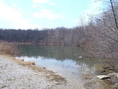
Whiskey Springs is a fire pond dug during the Depression by the Civilian Conservation Corps as a source of water to combat forest fires. It experienced a brief moment of fame in 2003 when the FBI drained the 1-acre pond in search of some of the components used to make the anthrax found in letters mailed following the attack on September 11, 2001 to political leaders and media outlets. All that is behind us now, and the lake sits quietly in a level valley filled with hardwood trees, Douglas firs, and assorted wildlife, with the 26-mile-long Catoctin Trail providing a highway for hikers and bikers near the pond.
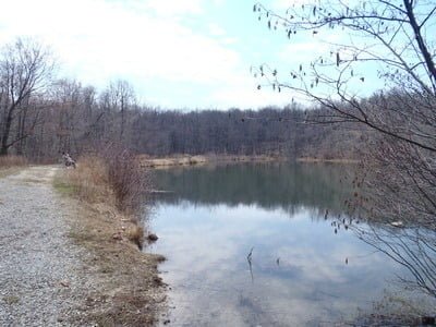
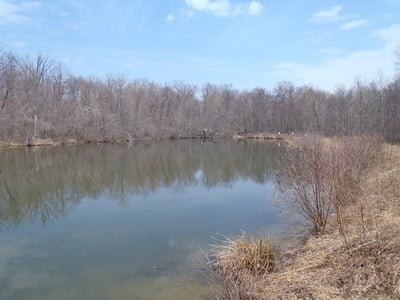
Since the pond is small, it may or may not be stocked depending on the rainfall. Therefore, pay attention to the posted stocking schedule to ensure that it gets its dose of fish. The turnoff to the pond is unmarked except by the intersection of the gravel road that joins Gambrill Park from the south. There are only a few parking spaces. Follow the remnants of the dirt road over the rough berm to cross the small spillway that ushers water out of the pond. This puts you on the southern bank of the pond, where the road continues to the western end. Most of your fishing will be from the south side, along this berm, since the northern bank is packed with trees and dense bushes that leave few openings to reach the water.
The pond is reasonably clear of lure-clogging vegetation during the stocking season. From the southern bank, the depth drops off quickly to approximately 5 to 6 feet deep within 10 feet of the shoreline. The western end of the lake is shallow and, as the season progresses, becomes clogged sooner than the rest of the pond.
Getting There:
North: From I-70, take exit 32A onto US 40E (or just take US 40 E from Hagerstown). Turn left onto MD 17N/Wolfsville Road. At the intersection of Wolfsville Road with Harmony Road/Middle Creek, bear left and take an immediate right to stay on MD 17/Wolfsville Road. Turn right onto Middlepoint Road. Turn right onto Tower Road when Middlepoint ends. Make a sharp left onto Gambrill Park Road. The pond is on the right approximately 500 feet from the turn.
South: From I-270, take Exit 32 onto US 15N/US 40 W. Merge onto US 40 W by taking exit 13B. Turn right on Harmony Road. Turn right onto Wistman Lane that turns into Crow Rock Road. Turn left onto Highland School Road. Turn right onto Rum Springs Road and then left onto Gambrill Park Road. Follow Gambrill Park for approximately 1.3 miles to reach the pond.
Access Point: Small turnoff adjacent to Gambrill Park Road (39.566646,-77.495044)
Whiskey Springs Pond Trout Fishing Secrets Revealed? No. This is a very public location that is documented in the Maryland DNR stocking plan.
Tell a friend about this article by clicking on this link

Access path to the pond

View towards western end

Southern bank

View to the east of northern bank
Unless stated otherwise, this article was authored by Steve Moore


