Approximate Boundary: 39.527831,-77.467189 to 39.550459,-77.481601
DNR Description: Left fork (also known as Steep Creek) above the confluence with Little Fishing Creek upstream of Fishing Creek Reservoir.
Type: Put and Take
The 15-foot-wide Fishing Creek offers spectacular “trout water” scenery and is a key destination for all types of anglers during the stocking season. In the Spring, the water runs swift and strong down a freestone course that includes a calm, flat section in the upper reaches with a quick transition into a dramatic canyon just south of the intersection of Fishing Creek Road and Mountaindale Road. The stream exits the canyon near 39.52943, -77.47226 for its final run to the junction with Little Fishing Creek and entry into Fishing Creek Reservoir.
The terrain surrounding the creek is extremely rocky and broken, with thick brush protecting the stream from anglers and the sun’s heat. Unfortunately, by late summer, the creek runs low and slow, limiting trout survival more so than the summer heat. For those who would rather not walk very far to reach the water, this is the ideal destination. The road parallels the creek throughout its entirety, with the maximum distance from the road to the water being approximately 30 yards except in the canyon section. In general, fishing is limited to the eastern bank as a result of the steep hillside that juts starkly upward from the western edge of the creek. In most areas, the creek is easily accessible as the water level is just below the height of the eastern bank.
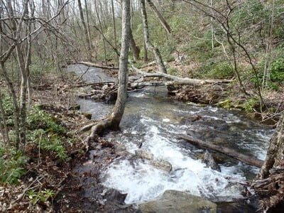
Above the intersection with Delauter Road, the creek runs flat through a narrow, level valley. During periods of high water, the creek overflows its banks and runs in random courses in the vicinity of Delauter Road. The creek runs shallow but offers pools wherever there is a slight drop in elevation. Plenty of fallen trees provide additional holding structure.
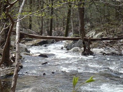
For the more adventurous, the canyon section furnishes a mountain trout setting with dramatic plunge pools sheltered by severe, steep cliffs on either side. The best place to enter the canyon is at the turn near 39.53549, -77.47339 , where there is room for a couple of vehicles to pull off on the side of the road. Look for and follow the small, dry streambed from its intersection with the road to the canyon. What awaits at the end of this short hike are spectacular small waterfalls, plunge pools, and clusters of logs that create fish-holding structures. Another option is to drive farther south to start fishing into the canyon at 39.53410, -77.47433 where the road begins to enter a left-hand turn.
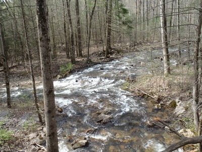
The lower section is unremarkable, but pretty. The creek runs adjacent to the road with plenty of turnoffs that allow anglers to access the water as it runs into the junction of Little Friends Creek. The creek narrows in this section to become 10 to 15 feet wide, running shallow near the confluence. Pools are dispersed and require walking along the side of the creek to discover. Unlike farther upstream, anglers can walk on either bank.
Getting There: From I-270, merge onto US 15 North in Frederick and continue towards Thurmont. Turn left onto Stull Road after passing Utica Park on the right. Follow Stull Road to its dead end on Mountaindale Road. Turn right and follow Mountaindale past the Fishing Creek Reservoir. The stocked section begins at the bridge crossing that marks the confluence of Little Fishing Creek with Fishing Creek.
Access Point: 39.527831,-77.467189
Fishing Creek Trout Fishing Secrets Revealed? No. This is a very public location that is documented in the Maryland DNR stocking plan.
Tell a friend about this article by clicking on this link

Upper creek

Upper creek

Canyon section

Canyon section

Junction of Fishing and Little Fishing

Little Fishing
Unless stated otherwise, this article was authored by Steve Moore


