It was a great 68 degree Fall day when I drove up to the Avalon area of the Daniels. This is another of those good Maryland streams that are close to the Basswife’s twin sister. Once I successfully execute the “you need to visit your sister” excuse, I do the standard dump and run and head to water.
After paying the entry fee to get into the park, I drove to the parking area and parked by the special regulation lake (16 and under), geared up, and walked down to the river. I did not really know what to expect. My last visit to Patapsco was earlier in the year when everything was blown out by rain. Thankfully, the water was looking good, running clean and clear.
I had no illusions of trout on this day. Maryland had not done their fall stocking due to water issues, but the material on the website advertised smallies. Smallies… trout… does not matter to me; I’ll go for either. I slid down into the river near the lake and started to walk upstream. Right away, the water looked good. I encountered a fairly wide, open area that would facilitate easy casting. The stream bottom was not rocky, with pitfalls lurking for the unwary wader. Instead, it was generally gravel and sand, with the large rocks scattered randomly. Even at the low levels at the end of a summer of drought, the center portions of the river were typically about 3 feet deep.
I warmed up by fishing upstream from the lake and then jumped out onto the wide bike path that parallels the river on the northern bank. After following it for about half a mile to put some distance between myself and the parking lot, I jumped back into the river only to be stunned by what I saw.
There is a road that runs the entire length of this river on the southern bank! What the heck is this? I ignored the road since I was already about 3/4 mile from the truck and just fished anyway. The river remained consistent from the start. There are few shallow sections where you can waste your time fishing. Most of this river is deep enough to hold fish and does. I picked up a smallie or two, numerous chub, but no bluegills. I saw other smallies scatter as I sloshed my way upstream. All were small; no trophies were visible or brought to hand.
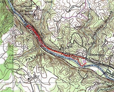
Later, after I was done here, I got back in the truck and did a vehicle recon. At the far right of the map, there is a road that cuts across the river. If you turn right where it joins the red/white road, it will take you for several miles right next to the river. The first thing you will pass is a large playground, something good to know if you need to dump the kids and spouse someplace while you fish a bit. Continuing on up the road, it swings back to the river and overlooks it all the way up to the top, where the road plays out into a large parking and picnic area.
At this point, you have to continue on foot. The standard bar gate blocks further vehicle travel. If I had known this, I would have driven right here and walked up (note: they probably do not stock beyond the end). The entire stretch shown on the map is fishable from the road. No physical challenge at all; just pull of and pop into the river.
On this day, I used poppers and my standard attractors and terrestrials. I tried a few streamers but did not have success. I concluded that I need to study streamer use better. I typically do the across, let it wash downstream with a twitch or two and then do an upstream retrieve. There must be better ways to deploy this weapon as I continue to have more success with dry and nymphs.
I used my 6wt 9′ and found it to be perfect for this water. There is plenty of room to cast, you never feel crowded or compressed. The typical cast to the good spots will be 30 – 40′ at most.
Patapsco River Fishing Bottom Line: I’ll go back here. I’m convinced that the water is better above the parking lot for smallies. By definition, anything where you have to walk has to be better! The DNR does stock this section, so it is worth watching the reports and come back after they complete that task. If you do, you may be as likely to catch a smallie as a trout!
Getting There: You will pay 2 bucks to get into the park.
The DNR has good directions:
“From I-95 – Take exit 47 and travel east on I-195. Take exit 3 to Elkridge. Turn right on U.S. 1, heading south. Take next right on South Street. Park entrance is on left.”
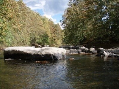
Decent structure
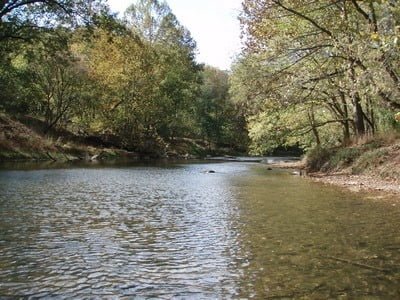
Easy casting – wide river
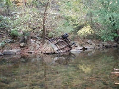
Some trashy scenery
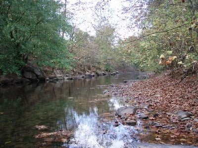
The river switches from side to side in terms of the deep areas. Here, it is against the rocks.
Unless stated otherwise, this article was authored by Steve Moore


