Unofficial Boundary: 39.691676,-78.780594 to 39.722801,-78.769276 (2.1 miles)
Wills Creek is not really a creek, it is a river. Wills was newly added to the stocking schedule in 2010 and has already earned a spot as one of the top stocked streams in the state, getting 7,225 fish in the Spring 2011 stocking season. The reason is clear upon visual inspection of the water. For arbitrary reasons, I’m dividing it for coverage at the confluence of Jennings Run.
At the lower end, the river runs 100 feet wide over a rocky bottom mixed with sand. Where the river levels out or turns the corner and loses velocity, more sand appears. There are plenty of deep spots, channels, and large rocks to create varied holding structures. Heavy vegetation grows on both banks, with tall trees throwing plenty of shade over the water. The banks are high and make for a skidding, full-contact entry down the muddy slope to the shoreline.
At the first access point at the end of Beach View Drive, anglers can take advantage of the deep water created by the confluence of Jennings Run with Wills Creek. A superb spot is on the east side of the railroad bridge. There’s a small trail that moves upstream from that point and provides access to the west bank.
The next spot is below the Pennsylvania border at the Forest Grove Road bridge crossing. Go across the bridge and Park on Kings Grove Road on the east side of the creek. Follow the fisherman’s trail that leads directly downstream from the western bank to reach the river. There is additional easy access on the other side via numerous dirt roads created by the dirt biking fanatics that cut wide paths through the trees. The creek runs about 50 feet wide and flat over a bottom that mixes small rocks and sand. There is a deep cut in the middle that is fishable by moving out onto the shelf above the bridge. The eastern bank slopes gradually up to join the heavily vegetated shoreline. Unlike farther downriver, the shoreline is not congested to the point of preventing movement. The view downstream is favorable. A massive gradient break creates a broad riffle where the river tightens up and narrows.
The final access point is adjacent to the residential area at the Pennsylvania border. Kings Grove Road runs parallel to the creek and provides several opportunities to turn out, park and walk across the 40-foot protective barrier of vegetation to reach the water between the bridge and the border.
Getting There:
From I-68, take exit 44 for Baltimore Avenue. Turn left onto Willowbrook Road (name changes to Baltimore Avenue). Turn right on Henderson Avenue to remain on US 40 Alt W. Make a right onto MD 36 S/Mt Savage Road. Turn right on MD 831C/Kreighbaum Road NW on the east side of Corriganville. Turn right on Beach View Drive. The parking area is at the end of the road.
Access Point:
·Parking lot at the end of Beach View Drive (39.695341,-78.78717)
·Forest Grove Road bridge crossing (39.718428,-78.771375)
·Pennsylvania border (39.723016,-78.769136)
Secrets Revealed? No. This is a very public location that is documented in the Maryland DNR stocking plan.
Tell a friend about this article by clicking on this link
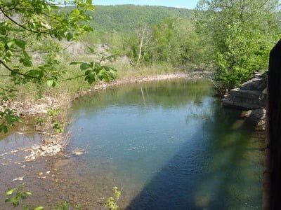
Pool at junction of Jennings Run
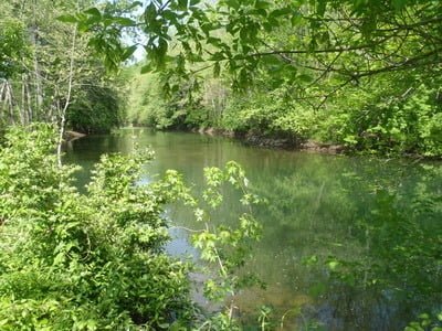
Upstream on Wills from junction
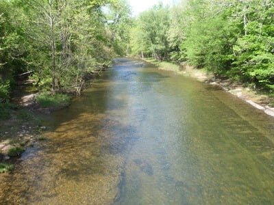
Forest Grove upstream
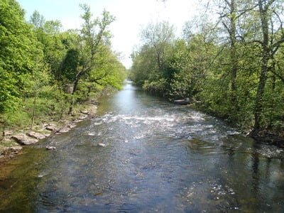
Forest Grove Downstream
Unless stated otherwise, this article was authored by Steve Moore
