It was a cold day on October 28 when my brother Dave and I hit Town Creek. The air temp was hovering around 45 or so with a stiff wind and spatters of rain. I thought the weather sucked. Dave, on the other hand, was disappointed that it was not worse – something I attribute to the fact that he went through the US Army Ranger course in mid-winter and has had an odd perspective on things ever since. Infantry Ranger types thrive on nasty weather and take great joy in relating any number of stories focused on how bad it can get; something I never understood in my years in the Field Artillery as I served in 2 different Infantry Divisions working in direct support to these guys.
Anyway, we fished the upper area until Dave ran out of the magic flies he purchased at the Angler’s Lie. Once he had to fall back on the generic stuff that came with his starter fly rod and the trout magnets I gave him, his luck evaporated. “What the heck” we said to each other, “maybe it would be better in the southern C&R area”. With that, we march-ordered our gear and drove the couple of miles south with the anticipation of discovery giving me a bit of a lead foot.
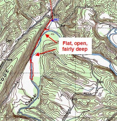
The lower section is very easy to find. A quick turn on Maniford Road plops you into the parking area about 50 yards in. The path to the river starts at the west end of the small lot and, after you get through the gate, it’s a nice level road down to the river. In fact, the road runs all the way down the west bank of the river until it plays out into a broad, open area where the river leaves the shelter of the steep cliff that forms its western boundary.
The river is uniformly wide and startlingly open. After my last couple of trips on the North Branch and Stony River where the water gets tight in places, Town Creek was like an ocean. It runs about 50 feet across and seems to have a uniform depth ranging between 2 and 4 feet. The current was moderate, running with a purpose but not so fast that it caused any issues with fishing.
I left the section closer to the lot to Dave and I walked directly down to the area where the road ended. I am, after all, driven by the need to see as much water as possible. On my walk down, I continued to be impressed with the uniform character of the river; a constant of width and open space.
And, that’s the problem. In his book, Guide to Maryland Trout Fishing, Gelso comments that the summer temperatures of the water can exceed 80 degrees – killing every trout in sight. While we were there during the C&R period and carefully released the fish we caught, what do you do in the summer? When the season opens to harvest these fish, should you? Does it make sense to release the trout to give it the opportunity to die a gasping death a month later as the sun bakes the water?
It’s easy to see how this happens. If you look at the pictures below, there is no overhead cover. In addition, I imagine that the steep cliff on the West end reflects even more of the summer sun into the waters. I’m going to hit the forums and start a thread on this to see what the consensus is on the right thing to do.
Dave’s luck did not improve with the move. The trout were not interested in anything he was putting in front of them. Now, he will be the first to admit that, as a new fly guy, his presentation may not have been optimum either. I caught a decent number of nice trout on various spinners but the number of leaves floating in the river caused most of the retrieves to foul – got to learn to fly fish.
Pressure: If garbage is the indicator, this place has not been overwhelmed as it was very clean. I happily kept my trash bag in the pack. Of course, this low pressure rating was derived on an intensely cold weekend in October, so I need to test the waters here again in the spring.
Physical Effort: Very easy. I’m not sure why Gelso wrote that the going was tough here. The road in this section allows for rapid movement and a quick envelopment of any unsuspecting fish. After the road ends, you are on your own and will need to walk in the creek or climb up the bank and bushwack through moderately tall weeds. Other than being careful on the depth of the water and the very steep banks to get to the creek, there are no obstacles.
Getting There: The DNR site has good directions. “From I-68 take Route 51 South at Cumberland for about 18.5 miles to Lower Town Creek Road and turn left. Continue 2.5 miles on Lower Town Creek Road and turn right onto Maniford Road. Proceed to the State Forest parking area on the right. The Delayed Harvest Trout Fishing Area starts at a red post upstream of the parking area and continues downstream 1.75 miles to another red post .”
One additional note – The turn onto Town Creek road is abrupt and you will come up on it pretty quick. If you are coming from the south, it will be a very hard right turn as the road hits Route 15 at a very acute angle
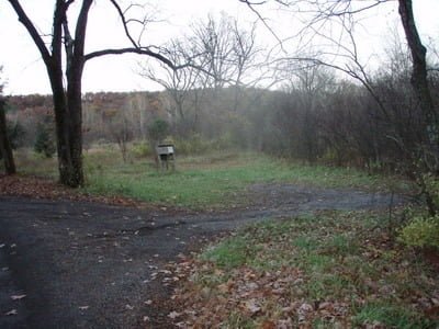
The parking area appears right after you make the turn
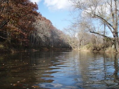
Section of the creek near the parking lot – wide and open
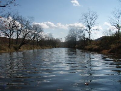
The southern section of the C&R area continues the open trend.
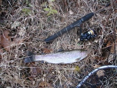
We fished after the section was stocked and were able to nab a few trout. As I have committed to learn how to fly fish this next season, this will be the last time I touch spinning gear in a while.
Unless stated otherwise, this article was authored by Steve Moore


