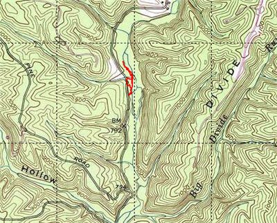
15 Mile Creek is exactly that; 15 miles of water. Sadly, not all of it holds trout and there are posted sections. 15 Mile Creek naturally falls into three zones – an upper, a middle and lower. The upper section is north of the interstate and is the subject of this post.
On March 29, Dick and I did our first joint trout strike of the season. We wanted to stay close, go to a stocked place, and see new water. 15 Mile Creek met all those criteria. After doing a map recon and reviewing the information from the Green Ridge State Forest website, we decided to start by working on the section that paralleled 15 Mile Creek Road. The 29th was the first day after the closure season in Maryland, so we did not have any illusions of privacy. There would be plenty of folks like us out and beating the water.
Having never been there before, we turned off of the interstate and went south. The theory was that the fish would wash downstream and that the road in this section was close enough to the creek to provide the DNR ample opportunities to deposit fish into the creek. After driving past a correctional facility, we hit the creek and the crowds. Every turnoff had a truck or two. We could see the creek, and we could also know that it was heavily populated with fishermen spread about 40 yards apart.
The water was surprising. It did not look that great. In this section, the creek appeared about 15 feet across, and we could see the bottom from the road. The creek did not have any sections with a deeper shade of green that would indicate a hole, so we were perplexed at what spots the folks could be fishing into. Maybe the freshly stocked trout were lying on the bank waiting to be picked up. We continued downstream, not wanting to join the crowd here, following the rutted dirt road. Our map recon promised that the road would veer close to the river again, and that was our target.
Continuing south and turning off onto Dughill Road, we ran into a flock of “Posted” signs. Yes, there is private property in the middle of the State Forest. We could see the creek in the distance and hear the breakfast noises of a large party of campers drifting up the steep hill. Must be a group camping location. Skidding in the thick mud that coated the road, we drove to campsite 79. It looked like the road ran close enough to the river between sites 79 and 78 to allow access. It turns out that these campsites perch on the top of a ridge, and it would be difficult to climb down to the creek and back. Wary that this would be a wasted effort since trout do not hold over in the creek and not wanting to rely on washed-down trout, we reversed course to check the creek above the interstate.
After crossing the interstate, we continued to follow 15 mile road up to campsite 2. Again, we noted that every pullout was occupied and that there were a mass of folks huddled around the bridge over the creek, all within feet of each other as they plumbed the depths of a single pool in search of trout. We decided that it was not going to get any better, so we continued up the road another 100 yards and then pulled off into the first available turnoff.
After gearing up, I walked to the creek to see several decent sized golden trout and a few rainbows in a 20-foot-long pool at my feet. Super! The stockers had not been cleaned out. I waded in and started working the hole. First with a BWO with a midge dropper, then with a bugger, then with an attractor with a small prince nymph, then with a trout magnet. Nothing. The fish would follow for a while and then turn tail. At least they were active in the 46 degree water, but nothing I had would interest them.
I decided to move on and worked my way upstream. The creek up here is narrow. That allowed the small amount of water to pool up and cut deeper runs in the channel than we saw down below. In short, there seemed to be more places that would hold fish up here, but since we did not get out of the truck to do a physical recon below the interstate, my impression may not bear true.
I walked up about 300 yards, peering into the clear, greenish-tinged water looking for movement. Nothing. I chatted with a spin guy who was coming downstream. He had not seen anything upstream and said there was another party about 50 yards up. So, I turned around and headed back downstream after telling him about the pool and the goldens. Maybe he would have better luck.
I met up with Dick about 50 yards down from the first pool. He had been hammering a hole where there were a number of nice trout scampering around. Like me, he had no luck. Since he actually has skill on his side, I did not feel bad about my results. I worked his pool for a bit as he headed back to the truck and then cut to the road to join him.
As we packed up to move to the middle section of the 15 Mile Creek that was at the next exit to the East on the interstate, a saw a different spin fisherman emerge from the first pool with a nice rainbow. I asked him what he used to understand where I fell short. Turns out the rainbow hit on a gold-colored spoon – rats – I should have used a bugger with more sparkle to it. Another day.
15 Mile Creek Trout Fishing Bottom Line: I would only go back to this section after a stocking. From watching the activity, it is clear that this gets cleaned out pretty quickly. The stream is small enough that the trout do not have anywhere to hide, they are visible from the bank in most places. The creek up here also does not appear to be deep enough to hold any other interesting fish, like a smallie.
Getting There: From I68, take exit 62 north on 40. After about a 100 yards, turn left on Fifteen Mile Creek Road. Drive over the bridge and look for campsite 2. Start fishing anywhere around there.
Secrets Revealed? No. This is a very public location that is documented in the Maryland DNR and Green Ridge websites
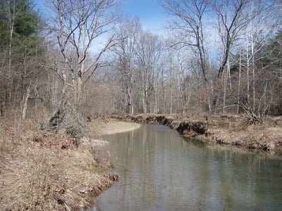
The first pool with the Golden trout
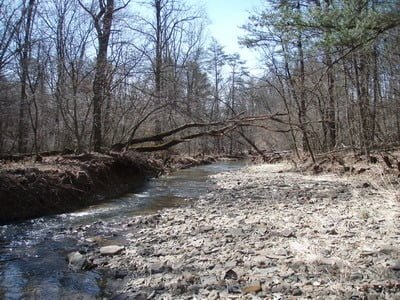
Upstream the water gets tight
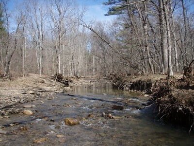
The creek alternates between tight and wide.
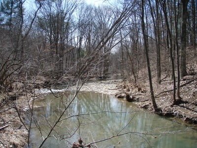
Each tight run opens up into a broader, sometimes shallow pool
Unless stated otherwise, this article was authored by Steve Moore


