If I had only studied any book in school as hard and as constantly as I do the Flyfisher’s Guide to Virginia, I would have been a genius. Anyway, that didn’t happen, so I’m stuck going fishing in my spare time… and loving it. A place that has been on my mind for many months is the mainstem of the Shenandoah. The Flyfisher’s Guide discusses access at Morgan Ford and stresses that the upstream section is the best part of the Shenandoah for smallies. The Guide intends that the description include the entire 3-mile stretch from Morgan Ford upstream to the dam, and I can certainly verify that it is true of the mile of river that the Basswife and I fished.
The Basswife doesn’t get moving to early in the morning unless it is Black Friday so we did not arrive at Morgans Ford until 1 PM on a bright Saturday afternoon. Four guys were wade fishing, wrapping up their morning on this stretch of the river. Three of them had waded upstream and focused on the dense tree structure that crowds the east bank while the other had worked the riffles downstream from the bridge. In chatting with these guys, they painted tantalizing word pictures of massive largemouth bass caught on the upstream side. The downstream fisherman did not have any comparable stories to tell.
Given the Basswife’s concern about rapids and fast water, I immediately decided to motor upstream. The river upstream from the bridge is fairly lake-like. It runs deep enough to use the trolling motor on the canoe, yet the current is not overpowering. Finally, there are no rapids that would concern the Basswife. A quick look downstream revealed that the gradient increases in that direction as the river runs over a 50-yard stretch of shallow riffles. Given the choice of making the Basswife get her feet wet, dragging the canoe back over that shallow stretch or not, I chose “or not” and maintained peace in our times. With that, we launched the basscanoe into the current and began the slow churn upstream at 2 miles an hour.
About a mile upstream, you encounter the first set of riffles and breaks which are framed by a small pocket of rocks poking up out of the river. If you maneuver your canoe carefully, you can get upstream with the motor. In fact, later in the day, we saw another group on a Jon boat charge upstream using an outboard motor They did not have any problem finding a path to penetrate even farther upstream than the trolling motor would take me. It must be nice to have the greater power of an outboard motor to blast through some of those fast water areas.
After turning the canoe around, I threw it into reverse, and we began to drift downstream while slowly throwing to both the bank and the center. Given that large smallies like to huddle under the trees on the bank during the heat of the day in the summer, it’s also true that in a river with a rocky bottom, they could be anywhere. While the initial part of the river near the bridge is unremarkably sandy, the closer you get to the riffle section, the more rocks and underwater structure you see. Sure enough, we began to pick up fish as we drifted downstream. Nothing to brag about, but we did have decent action. We were using spin gear, throwing small 3-inch plastic grubs. alternating them with spinnerbaits (Panther Martins) and 6-inch plastic worms. I was trying both the Powerbait and Gulp! flavors with equal success.
As we drifted downstream, we stuck fairly close to the western bank as it appeared to have better structure near the rocks. We picked up fish wherever there were logs that had fallen into the river. Farther down, I moved into the center and discovered deeper water where the fish were also holding. The key trick is to get your bait all the way down to the bottom. I found myself using 1/4 ounce weights to get to the bottom and overcome the fairly strong current.
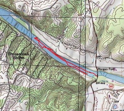
The river is wadable if you select your path carefully. My observation was that you could work upstream on the east bank as well as walk the center. The deeper holes were randomly spread across this stretch of water, so you may have to double back if you encounter one. As I motored up and drifted down, I saw we were just as likely to be in a foot of water as we were to be in four or five. I did not discover any spot deeper 6 feet in depth.
At the end of the day, I switched over to the east bank to fish the increasingly dense tree structure on that side downstream of the few houses we saw. There is one obvious spot where a number of trees collapsed into the water and border a large log lodged parallel to the direction of flow. This labyrinth of bass structure was enticing, so we slid over and got into position.
I get a kick out of the Basswife. Catching a fish always comes as a total surprise to her. Her first instinct is that she’s hung up and she accidentally sets the hook as she give it a jerk to free it. Then there is a little delighted girl squeak as she realized it is a fish and starts the fight. Eventually, the fish is pulled to boat where I, as the guy, get to handle the slimy fish, pop it back into the water and rebait the hook or change her lure. Must be nice to have a live in guide!
We weren’t working the labyrinth for long when I heard one of those squeaks and, as I looked up, a massive bass launched itself out of the water; shaking its head in a futile attempt to dislodge the hook. It took her a few minutes to get the beast to the boat given her gear – she likes a rod and reel combo that is about one grade up from a Barbie set.. In spite of that, she landed the fish – it was her biggest fish of the summer.
Shenandoah Main Stem Fishing Bottom Line: I really enjoyed Morgan Ford. There is plenty of water here to spread the pressure. I doubt many of the waders move very far from the bridge. In addition, the river is so broad that it would take several visits to really cover the entire section. I was surprised by this because if you look on Google Local, (or even on the map above) you will see a housing area in close proximity to the river. Guess all those guys follow my rule of needing to drive 2 hours to fish somebody else’s water. They are certainly welcome to come to the Occoquan where I live!
Getting There: From I66, take exit 13 onto VA79 towards Linden. Turn left on Apple Mountain Road followed by a right on VA55. Turn right on Dismal Hollow Rd and then right again on Happy Creek Road. Happy Creek turns into Morgan Ford Road and will take you to the river.
Google Local Coordinates: 38.958144,-78.120818
Secrets Revealed? No. This is a very public location that is documented at the Virginia VDGIF site and in the Flyfisher’s Guide to Virginia
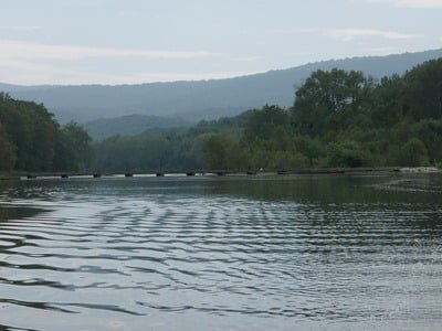
Downstream looking back to the bridge. The launch is to the right
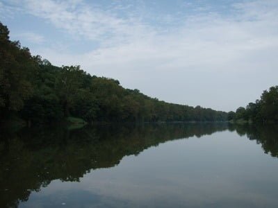
Upstream – looks deep, but it is wadeable if you pick your path
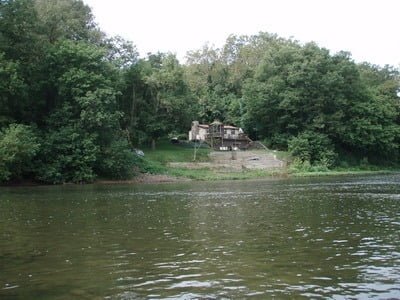
There are homes spread along the east bank
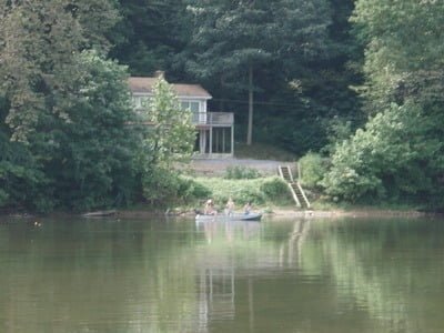
Another family out fishing on the day we were here
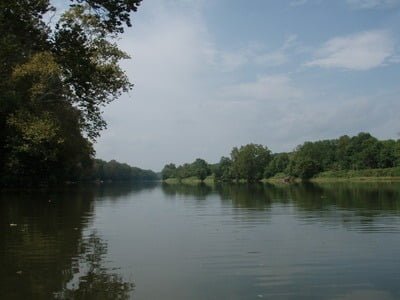
A look farther up stream
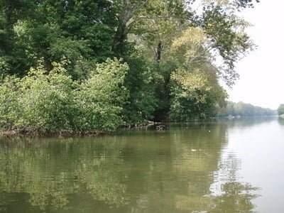
Tight structure about 200 yards upstream from the launch where the Basswife pulled in a 18″ bucketmouth.
Unless stated otherwise, this article was authored by Steve Moore


