My son, Chris, and I decided to run down the South Fork of the Shenandoah to visit and fish at as many of the public access points documented on the VDGIF site as possible. Sadly, we chose a day that was intensely rainy to conduct this experiment. But the benefit of the poor weather was that we were not tempted to stand and fish in the rain except at the best spots.
By the time we got to the Newport launch site, the rain had moderated. Perfect! This was one of the best places we visited all day. The launch area is broad, wide, and suitable for dropping kayaks and canoes into the river. Just upstream of the launch point is a steep riffle bed that prevents the upstream movement of any boats. Downstream, the river broadens and is reasonably deep until you hit the riffle structure, which you can see on the Google satellite picture of the downstream section. Since we were only doing a quick fishing recon of the site, we focused our attention to the area near the launch.
Normally, that strategy is a formula for failure as the area around the public access points experiences the most pressure. On this day, there were plenty of nice smallies lurking just below the riffle bed as well as in the deeper section upstream. Chris was using spin gear; throwing small crank baits into the deep area just below the riffles. He stood in the same place for almost an hour and caught a decent number of 10 to 13 inch smallies. I moved upstream to fish the weed beds on the right side of the river using poppers and successfully caught a few nice largemouth bass.
The river was up the morning we hit this spot, as it had been raining consistently most of the night before. That transformed the water from being clear to milky and added to the complexity of catching fish. It also probably sparked more interest on the part of the smallies with the increased amount of food washed into the river. They were not about to miss out on a feeding opportunity. I surmise that the crankbait Chris used was successful because of the vibrations it kicked out provided a homing signal just as and the noise of my popper generated attention.
I got a kick out of catching one sunfish and, as I retrieved it, a large bass followed it in and attacked it viciously at my feet. The sunfish was way too big to fit in the mouth of this thing, but I guess the distress signals emitted proved to be far too compelling and attractive to the bass. I watched the fight for about 15 seconds at my feet before I broke up the brawl. Of course, that bass showed no interest in my popper as I quickly flipped it in front of him after I released the panfish.

Chris moved downstream and I moved upstream. There’s a deep channel upstream that runs over a great rocky bed with decent sized boulders providing holding areas for fish. The river is wadable on the western side and I moved slowly giving extra attention to the weeds that line that side of the river. The bank drops off from them starkly enough to provide attractive holding positions for bass yet was not too deep to wade. Since the water was milky, I could not get a good eyeball on the depth of the middle and was not motivated to move out there given the swiftness of the current after the rainfall. I fished upstream to the end of the bend, and I could see folks from the private campsites moving out into the riffle farther upstream to begin their day of fishing. At this point, it started to rain again so I returned to the truck, and we continued our recon downstream.
Chris reported that he moved around the downstream bend in the river and continued to have good luck on the shallow shelf that extended out from the bend into the deeper sections.
SF Shenandoah Fishing Bottom Line: In a later post, I’ll provide the blow-by-blow on each access point we visited. This one was certainly a good choice and merits a return visit.
Getting There: The launch point is directly off of 340 south of Luray and Rt 211. Drive south from the 340/211 split and you will see the brown “Public Access” sign. You can see the launch area and river from 340.
Google Local Coordinates: 38.583109,-78.594496
Secrets Revealed? No. This is a very public location that is documented in the following places:
Virginia VDGIF
Flyfisher’s Guide to Virginia
Date Fished: 08/02/2009
Tell a friend about this article by clicking on this link
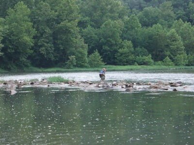
Chris in the riffle at the access point – taking off a nice smallie
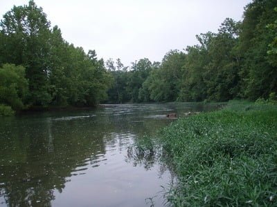
View upstream from the access point. The weeds are productive
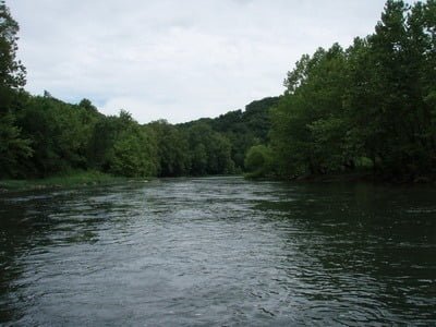
View back towards the access point from upstream
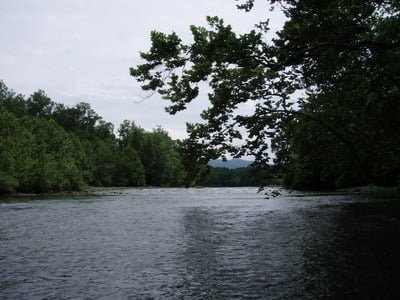
View around the upstream corner… there is a private, pay as you go camping area upstream on the right.
Unless stated otherwise, this article was authored by Steve Moore


