I have had my eye on the Shenandoah for the last four years but avoided it due to the major fish kill that occurred in 2005. Over the last month or so, I’ve seen other folks (mostly canoe outfitters) commenting that the fishing has picked up on the river. With that, I knew I had to return. My strategy was fairly simple. I would start in Front Royal and work my way south, hitting the various public canoe access points, hoping the river would be shallow enough in those areas to permit wading. Of course, I would not start blind. Rather, I would leverage the Flyfisher’s Guide to Virginia for advice on my first location — the Andrew Guest State Park right on the river.
It’s a short drive, a little over an hour, to reach the Park from Northern Virginia — something that makes it an ideal candidate for a day trip. The only confusing thing about the park is that all the signs on the road call it the Shenandoah River Park until you get to the entrance, where it mentions Andrew Guest for the first time. Head up the hill and pay the fee at the gate. It’s an honor system before the park people show up, and you need to hang the day access tag from your mirror so they can verify that you have paid. Drive down to the end of the road and hang a left to get to the canoe launch site.
I walked down to the launch point and looked up and downstream. My assumption was that the water in the park would experience more pressure, so I was looking for a way to move upstream from the park on the way from the “crowds”. I wandered to the end of the parking lot and saw a trail that headed West. According to the sign, the trail would end in 3000 feet. Sounded good. That distance would move me from the parking lot and any imagined pressure. Once at the end, I would bushwhack my way over to the river. It turns out that the trail hits the river at the other end of the peninsula formed by a bend in the river — no bushwhacking required.
As I looked up and downstream from my entry point, I was thrilled with what I saw. The river is very wide and shallow at this point — perfect for wading. The trail dumps you onto the river on a set of riffled rapids that provide oxygenation and shelter in deeper holes where the fish would hold. The only negative of this spot is that there is a campground across the river. However, on this Friday, it did not look like there were many campers, and I assumed that many of those folks would not venture beyond the bank to wade into the river to fish.
I rigged up my fly rod with a barrel swivel and sliding weight on the end of the 4X tippet I was using and terminated the rig with a small 2-inch plastic grub. I flipped it out into the current, removed the slack from the line, and let it drift downstream. I started to pick up fish within my first five minutes. Of course, the bluegills are alert for anything moving downstream and are happy to grab a small plastic grub. These bluegills are huge! They have an explosive strike, take a quick, aggressive run, and then poop out as you haul them to hand. In addition to being positive fishing reinforcement, they do give you a little bit of an adrenaline bump. But what of the smallies?
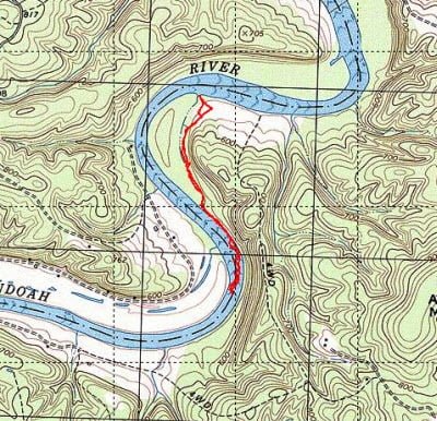
About every fourth fish I caught was a smallie. They ranged from 6 inches all the way up to 13. I was encouraged to catch the larger smallies as it proved that the river was bouncing back from the fish kill in 2005. Of course, any smallie of any size will give a heck of a fight in fast water. The intensity of the action in this area is demonstrated by the fact that I did not move that much. If you look at the map above you can see that I only moved about a half mile upstream of my entry point. I spent five hours in this half mile — it was that good. Thankfully, the river did prove amenable to wading. While there are deep holes (mostly against the bank near the campground) there are plenty of shallow lines of rocks that you can follow to move upstream.
The water moves quickly through the riffles and you did need to be careful as a loss of footing might cause you to topple downstream. I found that I needed my wading staff for additional support to move in the river. Given the success I was having on the grub, I stuck with a subsurface attack for the entire duration of my visit here. I now wish that I had switched to poppers when the sun came out to work the shade along the banks. Since being on this river, I fished a few other places and have kicked out large smallies that were loitering in the shade for protection from the sun as I walked along the bank or went to the bank to retrieve a fly in a tree.
Even though I was here for many hours, I did not see anyone at the campground venture out to fish. Either they’re all smart enough to do it early in the morning (before I arrived) or in the evening when the bite is on. Based on my results, I think you are okay in terms of pressure on this stretch. If I had had more time, I would’ve worked downstream around the peninsula and back to the canoe launch point. However, I wanted to visit one other location on the South Fork on this day so returned to the truck and moved out over the lunch hour.
Shenandoah Fishing Bottom line: I’ll thrilled that the Shenandoah is back as a viable fishery. It’s miles and miles of good water with reasonable access at the canoe launch points and is reachable with a moderate drive from Northern Virginia. In addition to the canoe launch points, I bet you can talk to campground owners and, for a small fee, gain access to their property to fish. Once I run out of the public access points and may have to investigate that option. The river in this area had to be 50 yards wide. With that much water, you can spend a long time on a very short stretch. This makes the Shenandoah a good option for those who can’t move around as much or want to return to their truck for lunch instead of having to haul it with them.
Getting There: Follow Route 340 south from Front Royal. The Park is on your right after you go through the town of Limeton
Google Local Coordinates: 38.863395, -78.310027
Secrets Revealed? No. This is a very public location that is documented in the following places:
Guest State Park Site
Flyfisher’s Guide to Virginia
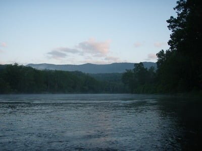
Downstream from entry point
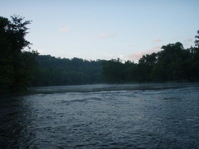
Upstream from entry point
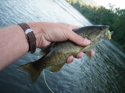
Typical smallie – all fish were released
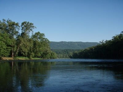
Downstream from turn point
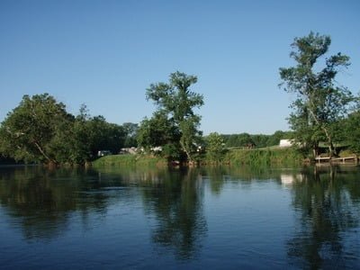
Campground across the river
The deeper runs looked like they were closer to the campground bank. There is a nice deep spot at the left of the picture (the picture to the left of this text)
Unless stated otherwise, this article was authored by Steve Moore

