This report is why this web site is worth reading. Here is what the MD DNR says about this special regulation section (my italics):
“In November of 1997, catch-and-return black bass regulations were enacted from Interstate 70 downstream 3.75 miles to Frederick Road (Route 144) in Ellicott City. The regulation was proposed to evaluate the response to catch-and-release angling on density and growth of smallmouth bass in this portion of the Patapsco River. Preliminary results of an on going study indicate an excellent population of smallmouth bass ranging from 26 to 77 pounds/acre. The smallmouth bass population is similar to other small rivers with most of the fish under 12 inches in total length.”
When I read that for the first time, my casting arm twitched. Even though it was late fall, I decided to do a recon trip to get a sense of the terrain. I posted the reconnaissance results back in January 2008 and indicated that it looked promising but that I needed to return in better weather. Over the Fourth of July weekend, I was able to do that.
Based on the protected nature of this stretch of river for the last 12 years, I anticipated encountering a vibrant population of smallmouth ranging up to 12 inches in size. What I found were plenty of sunfish and no smallies. Well, I did catch one 6 inch smallie but that was it. So why is this posting special? I’m going to save you a wasted trip and wasted gas by telling you that this spot is horrible… other than the scenery.
Back to the Patapsco. Since I wanted to get a view of as much of the special regulations section as possible, I walked for 3 miles down from the parking area to the US 40 bridge. After chatting with the guy fishing for sunfish under the bridge, I walked upstream in the middle of the river. The first red flag was that the bottom was nothing but sand protected by knee-deep mud near the banks. After catching as many sunfish as I wanted, I began to accept that this area would not be productive for smallmouth bass. In the 2 miles between the bridge and the point marked on the map, the bottom is consistently sandy with very few deep sections. I was able to walk in the middle of the river for this entire distance without any problem at all. The water was knee to thigh high. with a few deeper spots clustered under some trees that shelter the banks.
I had a great day catching sunfish, and I actually caught two at the same time when I was using a popper and a dropper. In this entire stretch, I did not round up any bass at all. After a while, I got tired of catching sunfish and began to slosh noisily upstream to see what I could scare up. I saw plenty of sunfish scattering out of the way, but nothing that resembled a bass.
Once I reached the point marked on the map, the river’s character changed and became more bass-friendly. At this point, the bottom structure changed to large rocks and gravel with minimal sand. The closer I walked to the I70 bridge, the more I saw boulders and rock ledges that would typically mark good habitat for bass. It was in this area that I picked up the single smallie that I had caught all day.

So what’s the deal here? There was plenty of water in the river and it looked like it was running at normal flow. I can accept the fact that there would not be any bass in the extended sandy stretch, but what about the 1 mile of rocky area? Given that the bass have had 12 years to reproduce protected by a catch and release regulation, I have to conclude that either the experiment failed or that they were cleaned out by poachers. I don’t get the sense that this section of the river is pressured at all. I did not see any evidence of humans once I got below the I70 bridge. Granted, there were a few people hiking down the train tracks without fishing gear and I did see a family swimming near the I70 bridge, but no fishermen other than myself and the guy sitting under the US 40 bridge catching sunfish for dinner. There were no bait containers or other evidence of fishermen – nothing.
Patapsco River Fishing Bottom Line: This section is a total waste of time in the middle of summer. It’s probably even a waste of time during trout season as I doubt the many trout migrate this far downstream from where they are stocked in the Daniels section. Maybe I’m the last guy to figure this out given the lack of evidence of other fishermen. At least my experience and warning will keep you from wasting your time and gas to visit this section.
I know that I treasure every minute I have that I can spend fishing and I would certainly rather go someplace where I’m in a catch fish other than sunfish. On the other hand, if you are new to fly fishing, this is where you can get an education at the expense of the sunfish. Fishing here would put you on a stream setting with plenty of action that would allow you to develop your skills using dry flies with the sunnys providing instant feedback on your presentation.
Getting There: From I695, take the Security Blvd (Exit 17) westbound. Turn left on North Rolling Road and take the next right on Fairbrook road. Go about a mile and turn left on Johnnycake Road. Follow Johnnycake until it deadends into Hollowfield Road. Turn left and follow it over the bridge. The parking area is on the left before you get to the railroad tracks.
Google Local Coordinates: 39.309879,-76.793618
Secrets Revealed? No. This is a very public location that is documented on the Maryland DNR Patapsco page
Date Fished 07/04/2009
Tell a friend about this article by clicking on this link
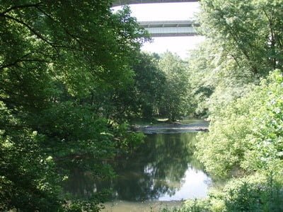
Looking south to the I70 Bridge

Downstream from I70 bridge

US 40 Bridge area
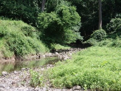
Don’t get excited about fishing the junction of Cedar Creek with the river… this is it.

An endless dead zone – totally sandy bottom
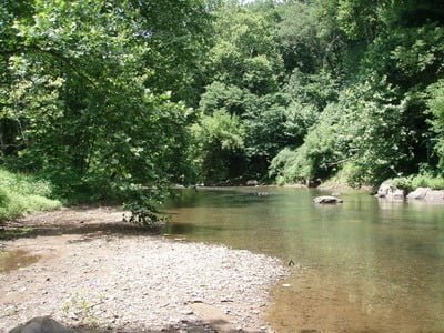
Continues for miles upstream
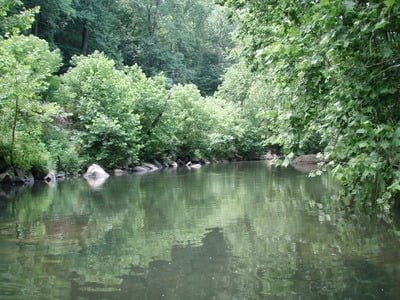
Bass water around point marked

But… it is a pretty section and there are plenty of sunfish
Unless stated otherwise, this article was authored by Steve Moore


