For the last several years, I have driven over Bull Run Creek on Route 28 to Dulles Airport. Each time, I look at the small sign marking the upper reaches of the Occoquan Water Trail and tell myself that I need to stop here and fish. After all, it is local! Finally, I ran into a day where I only had a few hours to fish, which made visiting this spot mandatory.
I rolled in here at about 7 AM and was surprised to see another truck parked there. I think he was a commuter because he did not look like he had anything to do with fishing or canoeing. With a cheery “good morning” to that poor soul who had to drive to work, I headed to the creek to look around to see what was there. The parking lot borders a small set of riffles that parallels Route 28. There did not appear to be any significant difference in the look of the water as I gazed up and downstream, so I decided to move up.
Bull Run Creek is surprisingly deep. In the first pool near the parking lot, I could only wade about 20 feet upstream before it got too deep to continue. I was working poppers and terrestrial patterns, anxiously targeting the rises I saw early Friday morning. After picking up a few bluegills, I decided to get out of the water and see if there was a trail that paralleled the creek. Sure enough. It’s a great, well-developed trail that appears to run the entire length of the northern bank. As I observed the southern bank later in the day, it looks like there is decent access on that side.
After following the trail over a small hill and into the park about a quarter mile, I cut back to the creek and to fish again. This is a perfect stretch of water for anyone learning how to fly fish. It’s not that deep upstream of the initial pool, and plenty of room to cast and practice while wading. The bushes and trees are kind, being spaced far enough apart to avoid capturing your fly on an errant back cast or poorly executed forecast. The active bluegill population provides instant feedback to your ability to drop the fly on the water and not spook the fish. Although I have to admit, I’ve never seen a spooky bluegill. I worked upstream for another 1/4 mile, catching bluegills as I went. This caused me to wonder if there were any bass — largemouth or smallmouth — in this water. After another hour, I had to head home, so I walked downstream, looking into the water to see if I could observe anything that I had missed earlier.
As I passed the head of the long pool, which marked my initial encounter with the creek, I saw several large, shady forms hovering several feet beneath the surface. As the sun hit the water, they slowly rose out of the murky water to reveal themselves – they were large bass. Jackpot! There are bass in this water and, so far, I was just not good enough to catch them. I worked my way around a huge, downed tree to get into position to attack. There is a steep ledge in this section, which actually makes it fairly easy to move into position with the rocky outcrops it provides, offering plenty of footholds that allow you to position yourself in the middle of the pool. From here you can cast up and downstream with relative ease without worrying about obstacles. I worked this section for another 30 minutes but did not have any luck. Those tantalizing black shapes continued to cruise around and totally ignored everything that I threw at them.

Bull Run Creek Fishing Bottom line: While I will come back here and fish downstream just to see what it is all about, I do not think I will move upstream again without further confirmation that more bass exist beyond the first pool. One of the things I wonder is whether the riffles that follow the route 28 roadbed have effectively cut off upstream migration of larger fish. However, the fact the bass I saw exist in the pool above the riffle indicates that they have to be in this stretch of water.
Upstream of the initial deep pool, the water is a consistent 2 to 3 1/2 feet deep. It features a fairly smooth yet rocky bottom — not big rocks you will trip and slip over — but small rocks and pebbles that should provide a decent amount of habitat for the fish. There are, of course, sandy stretches which I skipped.
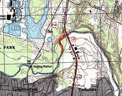
Getting There: Follow Route 28 north out of Manassas. As soon as you cross the bridge over Bull Run, turn left down a small road. This leads to the Occoquan Water Trail parking lot about 50 yards from the turn. It is at the base of the bridge.
Google Local Coordinates: 38.804130, -77.449820
Secrets Revealed? No. This is a public location that is documented in the website for the Occoquan Water Trail

The trail down to the water

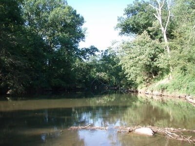
Looking upstream from the entry point

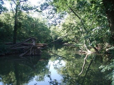
Looking downstream back to the Rt 28 bridge

Typical structure
Unless stated otherwise, this article was authored by Steve Moore


