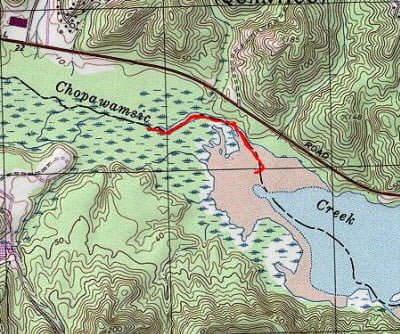
We didn’t have much time on a Saturday in late September, so we decided to drive down to the Quantico Marine Corps Base and fish some new water. We had hit most of the lakes documented in the Quantico fishing regulations but had not worked over the Chopawamsic Bay where the creek empties into the Potomac. In this location, the junction of the creek and the Potomac forms a broad bay that is probably half a mile wide. I had heard that, like the Potomac, this area was full of good largemouth bass (is there a “bad” bass? I don’t think so).
After finding the wildlife viewing area that marks the entry into the small parking location, we bumped around a small hill to arrive at the parking area and the unimproved launch. The launch is a wide spot between some bushes, which is perfect for hand-carried craft. As I stood there and looked out across the bay, all I could see was a sea of green. Lily pads were all over the place. This was not the case in the spring when I had done a quick recon of this site to check out other options at Quantico. Standing there, I assumed that this would be great as it provided plenty of good bass structure. I would change my mind about an hour later.
For no particular reason, we decided to fish towards the mouth of the creek, where it joined the bay. There is a 30-foot-wide channel that leads back up towards the creek, and we followed that. The channel is typically 5 to 10 feet deep and full of debris on the bottom. We had to be careful to rig our lures correctly or we would hang up instead of sliding that grub across the structure. We discovered that the channel is a bit challenging since it is so narrow. In effect, you can only fish directly forward or directly back as anything to the left or right of the canoe would probably be spooked. Given the tight quarters, I wished I had my fly rod with me but also knew that this late in the season it probably would not have been productive.
We got a few bumps and a few missed strikes, but nothing hooked on or brought to the boat. We decided to turn around and go south of the launch to investigate the broader bay. About 100 yards down from the launch, the lily pads closed in, and the channel was lost. At this point, if you were to fish farther down, you would have to bushwhack your way through the lily pads — something I was not willing to do in the canoe. We chatted with a few other guys who were fishing, and they had not caught anything; we had actually done better since we had some strikes.
Quantico Fishing Bottom Line: If are going to fish this location, you have to get here before the lily pads close you out. An alternative, which we did not investigate, is to go down to where the bay joins the Potomac River. I’ve been told that there is another boat launch down there. At that point, I doubt the lily pads would have closed everything out. Launching from that location, you could fish up into the bay to the perimeter of the lily pads and have a good time late in the season.
Getting There: From I95, take exit 148 towards Quantico. Turn east at the end of the exit and follow Russell Road onto the Quantico MC. If you do not have a military ID, you will have to show a government issued ID. About 2 miles from I95, you will see a small sign for a “wildlife viewing area” on your right. Turn onto the dirt road for the viewing area and it will lead to a small parking area where there is an unimproved launch. It might be sporty to get a trailer in here – I believe it is just for kayaks and canoes. There is an improved launch much farther down near the Potomac.
Google Local Coordinates: 38.514712,-77.334759
Secrets Revealed? No. This is a very public location that is documented on the Virginia VDGIF website and in the Quantico MCB regulations.
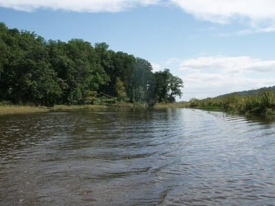
Looking back at the launch as we motored north
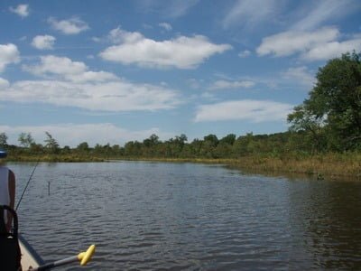
Upper section where creek feeds the bay
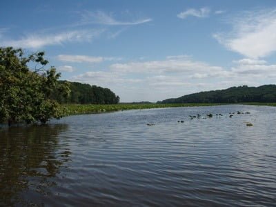
Downstream from the launch starts to get congested with lily pads
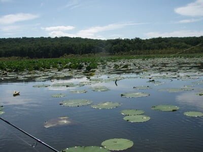
We could not get thru this in the canoe and turned back
Unless stated otherwise, this article was authored by Steve Moore


