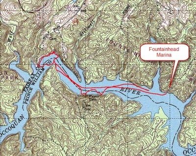
If you live in Northern Virginia and size matters to you, then you must visit and fish at the Occoquan Reservoir. The Occoquan has several access points all controlled by the local parks associated with either Fairfax or Prince William County. In earlier posts, I discussed fishing from Lake Ridge Marina and the launch at the Occoquan Regional Park. The problem with the Occoquan is that it is a huge body of water, so if you only fish from those two locations, you haven’t seen half the lake. With that in mind, I loaded the Basswife into the truck, and we drove over to Fountainhead Regional Park to see what the lake looked like at the northern end.
Like all the other access points, you must pay a fee to launch your boat, even if it is just a canoe dumped off your truck. You get a break on the rate if you are a resident of the county where the Park is located. In the case of Fountainhead, you pay a reduced fee if you are a Fairfax County resident. With an eye to the future, I asked about access from the Bull Run Marina Regional Park, about a mile or so upstream, and also in Fairfax County. I was stunned to hear that they only sell annual passes, which involve issuing you a key to get through the gate and to the ramp. That annual pass will cost $70, so unless you’re a constant fisherman in love with the Occoquan, it’s not worth it. With my el cheapo $3 non-resident canoe pass in hand, we drove the truck around the corner to the launch point, dumped our gear, and began to motor upstream.
This end of the Occoquan does not look much different from the lower reaches closer to the dam. While that is to be expected regarding the shore, I was surprised that the depth in the north end was as deep and dramatic as I had seen near the dam. I assumed that the lake would become shallower closer to Manassas. That’s not the case as we observed depths in excess of 30 feet in spots. This makes for tough fishing for folks like me who don’t have a lot of skill with some of the more appropriate deep-water techniques like drop shotting or jig fishing. Basically, all I can do is throw the plastic worm and bump it down the bank, hoping for a hit.
On this day, I also decided to attempt to work the banks with my fly rod—this was before the basswife placed the fly rod off limits for canoe use when I hooked myself in the back at Beaverdam Creek and had to have the Basswife yank it out. Since there was a little bit of wind and a small down-lake current, we decided to motor up the lake as far as we could tolerate and then drift back to the access point using the current and wind.
We picked up a few bass but nothing spectacular as we worked the shoreline and associated structure. The shoreline in this part of the lake is more dramatic than it is closer to the dam. My impression was that there were more cliff faces as well as more trees overhanging the banks. There are plenty of fallen trees pitched into the water, creating holding places for fish. The key challenge of the lake is that it experiences heavy pressure. This brought to mind an article I read several years ago, which not only said that 90% of the fish hold in 10% of the water but that the secret to a successful day was to find that small percentage of bad-looking water that actually holds a lot of fish since everything else will be pounded to death by the other guy.
In the Occoquan, I suspect that the bad-looking (but good) water is not visible to the naked eye; instead, it waits for you to discover it on your fishfinder. The shoreline all looks good so the only undiscovered sections have to be brush piles and other hidden structure at the bottom of the lake. I have not run across a topographical map that shows the lakebed, but I bet that it would reveal additional good channels which provide natural pathways for bass to move around. I can only guess at where those would be by observing the terrain surrounding the lake and assuming that every point would be the border of the channel and that every point might hold some nice fish — just like every other guy fishing on the lake
Every once in a while, you get lucky. I could probably make up some fantastic story about how I caught the monster in the picture below but it’s actually more interesting to tell the truth. I had just finished using my spin rod fishing a Texas rigged smoke colored YUM worm along the bottom. I saw a rise at the shore and hurriedly reached for my fly rod in an attempt to throw a popper over to that fish. In my haste I did not reel the worm all the way in and it was drifting in about 15 feet of water as the canoe drifted slowly down the shoreline. Just as I was about to cast, the spin rod took a deep bend; causing me to drop the fly rod in the bottom of the canoe and execute a panic grab. Somehow, I set the hook and the fight was on. A few minutes later I was stunned to see the biggest largemouth bass that I had ever landed. This sucker was 18 inches long — I just couldn’t believe it. The biggest largemouth of my life was caught by mistake.
But, this did confirm that the lunkers do live in the Occoquan and occasionally even a fisherman who relies on luck rather than skill will tie into one.
Occoquan Fishing Bottom line: Overall, I rate the Occoquan as yellow and this is primarily driven by the pressure that it sustains day in and day out as one of the top rated lakes in Northern Virginia which also happens to be in the heart of the population center. Maybe I would rate this as green if I had to drive two hours to get to it under my theory that the best water to fish is always the water in somebody else’s backyard. I sometimes wonder as I drive other lakes in the area if someone just down the road from those lakes is driving to fish the Occoquan which is a 10 minutes from my house.
The Occoquan is scenic lake, you don’t see many houses clustered along the banks as is mostly park along the banks. The water is clean, clear, deep and cold. If you can master fishing deep, you’ll have a good day on the Occoquan.
Getting There: “To reach Fountainhead, take I-95 south of the Beltway, exit at Occoquan and travel north on Rt. 123 approximately 5 miles. Turn left onto Hampton Road and drive 3 miles to the entrance on the left.”
Google Local Coordinates: 38.725577,-77.333193
Secrets Revealed? No. This is a public location that is documented on both the Virginia VDGIF site as well as the NVRPA site.
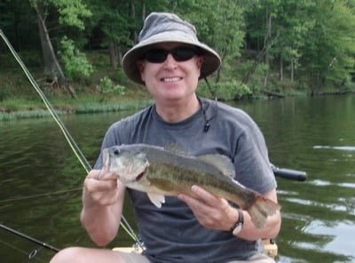
A lucky catch
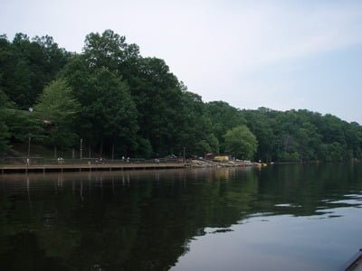
The launch area at Fountainhead
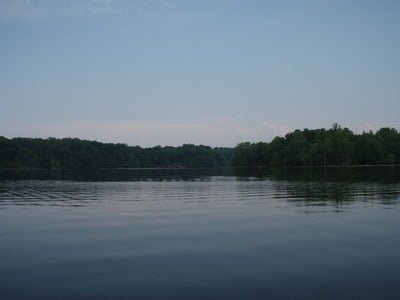
The lake is broad and deep in this section
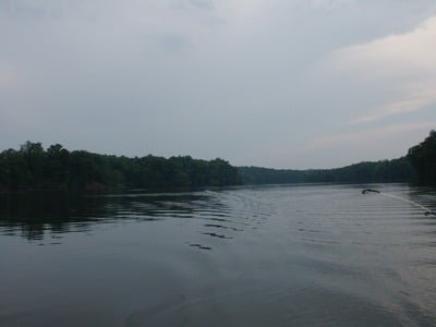
Unless stated otherwise, this article was authored by Steve Moore
