This lake is a loser.
We arrived around 11:30 or so and there were 22 cars in the parking lot. Since this is a park, that would not have been a big deal, but it was quickly apparent that all 22 cars unloaded people who were fishing. They were all over the lake and spread along the shore. Ouch.
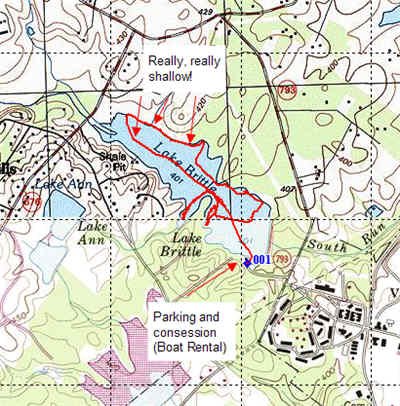
The VDIGF site shows a map that gives the depth of various parts of this 77 acre lake – and it is accurate. Most of the Northwest part of the lake is really shallow – around 2 feet tops according to my PiranhaMAX 30. the deepest part of the lake is on the Southeast side – near the concession stand.
In addition, there is NO structure on this lake. The shores are barren – no fallen timber, nothing to attract fish. I could not locate any sunken fish attractors either as a watched the fishfinder. By the way, there were few fish pings despite the extensive recon we did of the lake as you can see from the track.
The concession rents boats – which probably explains the pressure on the lake. We did not get one hit in the 3 hours we were there. I spoke to several other fishermen as we passed them in the boat – nobody was getting any action. Granted, this was the middle of the day, but my Hunt and Fish calculator on my GPS indicated that this was the best time fish on that particular day.

Gettuing There: Take Rt. 600 east from Rt. 29 and then turn right (south) on Rt. 793. Follow Rt. 793 to the lake.

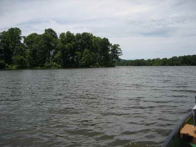
View looking North from the dock – it’s a big lake – but mostly a dead zone of very, very shallow water

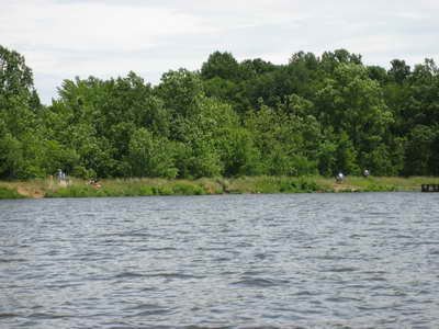
There were people all over the place fishing – the shore and the lake all supported a dense population of anglers.
Unless stated otherwise, this article was authored by Steve Moore


