

It was a sunny day in late September so, of course, we went fishing. We had not been to Abel Lake since 2006, and I was anxious to give it another shot. I remembered that on my previous trip, I was impressed with this lake and had resolved to get back to it much sooner than this. However, those who read this website understand my obsession with always going someplace new.
We bounced down the rough road into the launch area (low clearance vehicles need to take care of), backed up the truck, and began to unload all of our gear. As I pulled the motor out, I noticed that the battery to drive it was not in the back of the truck. That thing weighs about 40 pounds, so it’s always my responsibility to load it up. I confessed the lack of battery to the Basswife and immediately got “the look.” But all was not lost since I remembered bringing the canoe paddles. Given that we were not motorized, we would not be able to range as far down the lake as we had on our previous trip.
We paddled across from the launch point and began to work down the shoreline towards the Kellogg Road bridge. In short order, we picked up some small bass like the one below. Uncharacteristically, they were hitting on spinners instead of the plastic baits I usually rigged. Maybe it had something to do with the fact that the water was starting to cool down as we headed into the fall, and it was uncharacteristically clear, which provided the ability of the spinner to make a bigger impact than a slow, gently moving plastic bait.
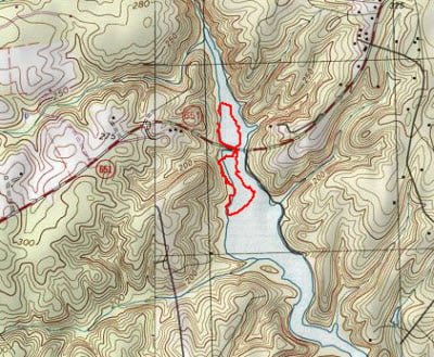
The water in this part of the lake was about to 10 to 15 feet deep 20 feet off the shore. It gets shallower farther up the lake and eventually tails off into a shallow foot or two, which might hold some bass when they move shallow to spawn (please catch and release any bedding fish!). We continued to fish and paddle down towards the bridge with a gap in the action until we got to the other side. A few guys were fishing from the south shore near the bridge, but it did not look like they were having much luck. We paddled around the bridge, giving them space, into a cove where we picked up a few more bass near weed beds on top water plugs. At this point, the wind started to pick up and blew us down the eastern shore at a slow, constant rate. I really missed having the trolling motor to be able to moderate our drift. Lacking that, we just fished as we went. I would paddle periodically to ensure that we were offset from the shore at the appropriate distance.
Being a little bit lazy on this nice Saturday afternoon, I did not want to go too far down the lake so I cut across to the east side where we began fishing our way back up. This was a little tougher going as I ended up doing more paddling than fishing to keep the canoe in the right place against the wind. Clearly, where the lake broadened out, the wind was having a larger impact on our ability to hold position. The east side of the lake is better looking in terms of shoreline structure than the west side. On the east shore, we found a number of weed beds that ran down into the lake to become the border marking a decent drop-off.
Date Fished: 09/2008
We caught another fish here, but I decided to pack it in to get out of the wind. I paddled back up to the bridge and turned left to work the west shoreline leading back up to the launch point. It was protected from the wind here so the boat could maintain position while we worked this area. It’s fairly shallow and we did not catch anything en route back to the launch point.
Abel Lake Fishing Bottom Line: I can’t believe it’s been two years since I fished Abel. I need to make an effort to get out of here again if I can tear myself away from the Potomac and Shenandoah and the pursuit of smallies. Even though there were plenty of other vehicles in the launch area, I do not have the sense that this lake experiences a huge amount of pressure since it is so large. This one’s a keeper and I’ll be back.
Getting There: From I95, take exit 140 onto Rt 630 towards Stafford. Turn left on Ramoth Church Road followed by a left on Kellogg Mill Road. Stay on that road until you reach the lake. The launch area is on the west bank after you go across the bridge.
Google Local Coordinates: 38.41271,-77.495499
Secrets Revealed? No. This is a very public location that is documented on the Virginia VDGIF website
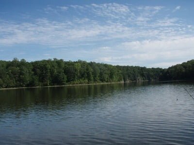
Looking down the lake from the launch area
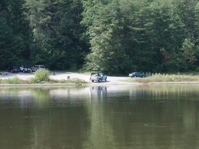
The launch area
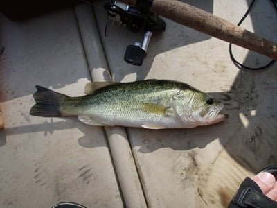
Typical bass – we released everything we caught
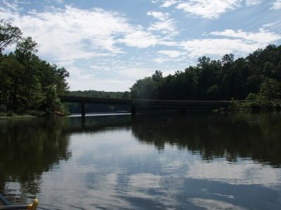
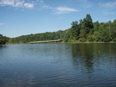
Looking south beyond the bridge
Looking back to the bridge
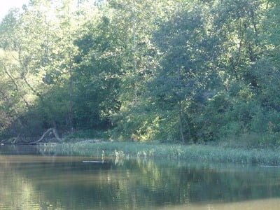
Shoreline to the east of the launch
Unless stated otherwise, this article was authored by Steve Moore